
During the last major trip I took, one of the SMB forum members (Ray) who goes by the screen name of 1der wanted to get together and do a coastal trip in September but that fell through for both of us. But Ray and his wife Jennifer, asked me to join them in Yosemite Valley for a little October camping trip and hoped that I’d bring my buddy Don with me who was also at the Leavitt Lake Forum meet. Because most of the month of September and October was shot due to some engine work I’ve wanted to do over the past several years, I was ready to get out to test the new engine upgrades before heading out on any major runs. Unfortunately I had some suspension work that need attention and my refrigerator gave out on me. What an end to the summer. I was amped up to do some easy camping before the major weather change of autumn hit the Sierra’s and Yosemite would be a good test run provided it all came together before November. Ray had made room for my van if it was going to done in time but I was actually contemplating pulling out the tent and make a return to pre-Sportsmobile days using my old Chevy pickup. Thankfully that didn’t happen.
A Halloween trip:

With the engine work done and the suspension repaired, the refrigerator was the last issue to tackle and it only put me 2 days behind. Using a couple of vacation days, I left out of town for Don’s place on the 29th of October. Unfortunately it coincided with the last game of the World Series and Don is an avid Giants fan. At least we were able to listen to it on the radio as we made our way to the park. Ray held a site for us in Yosemite’s North Pines campground. Although I’m not a fan of most any busy campground, especially the tightly packed spaces of Yosemite Valley, the fact remains that the park itself has a lot to offer. It’s hard to beat the surrounding mountain vistas while hiking or bike riding if you’re into that. Even though the waterfalls are almost nonexistent at this time of year, the autumn colors make up for the lack of water. Don and his wife Helen had just been up there the week before and the trees were just starting to change. Lucky for me, Ray’s trip coincided with some major color changes as the weather cooled. Sometimes it’s hard to hit the date correctly. Besides the fall colors ramping up, there are nearby spots to off road that appeal to me. But I was here to see friends and a couple of nights in “the zoo??? was fine by me.

(Ray, Jennifer, Trisha, and Don)
So about 8PM on the 29th we rolled into camp after dark. It was good to see Ray and Jennifer again and they also had a couple of other friends along with them. Trisha was also from the bay area and had driven up to camp. Randy and his wife Lisa were from out of state and had arrived with a large motorhome towing a Jeep Rubicon. The evening was shot by the time camp was set up, so we didn’t even get a fire going.

The World Series was in the last stages of the game and there was a blast of yelling by everybody in camp when the final play was made as SF won the pennant. OK I was camping with people from SF but it was hard to believe there weren’t any folks in Yosemite Valley that were Giant fans cause the only yelling came from our group. Maybe they were all in their RV’s.
I will admit it was remarkably quiet during the evening hours. I’ve camped in the valley throughout my life and had never seen it so quiet. I’d hate to think the quiet was due to everybody having their heads stuck in their smartphones. Yes, I had an internet connection. In fact I took care of a few forum admin duties before retreating to bed but I would have been happier making a ruckus around a camp fire with a beer in my hand. Don and I cracked open a couple bottles of rum and finished the night with conversation and music before calling it an evening. Both Don and Trisha were in tents but the night wasn’t as cold as I had thought it might be. I even had all my windows open and enjoyed the cool evening. It was perfect weather IMO. Cool enough for a fire but warm enough that I didn’t have to run a noisy heater.
In the morning with the sounds of generators starting up, the campground came alive as breakfast was being served. Generators are definitely not my favorite aspect of camping in populated areas but it’s part of the campground experience these days. Even with the engines running I still enjoyed sitting outside sipping a hot beverage while the air was brisk. I’m not one for huge complex meals on the trail but when you’re with friends you go with the flow and I’ll admit Jennifer & Ray go beyond the norm. Fantastic food morning and night. That morning Ray had their big grill going making a traditional breakfast. Hey the smells of bacon, sausage and burnt toast filled the air which is the essence of camping IMO. Coffee is more important to me and several shots of espresso did hit the spot. I did grab a sausage off the grill when offered and made a makeshift sandwich with my bagel. After the caffeine boost, the tone was set for the day. Both Don and I wanted to get out of the valley but Yosemite is a spectacular place even with all the people. We had actually planned to head into the backcountry but Ray & Jennifer convinced us to stay another night. So we decided to stay over and this time have an evening fire. Unfortunately we had to move to a different spot but it was only a couple sites down. We even pushed my trailer to our new camp.
Being in the valley always takes me back to the 60’s and supplies a connection to my past. In the 1960’s the camps were similar to today but generators were few and far between. My family had a very small trailer that my dad would pull up to the valley 3 or 4 times a year. The counterculture during those days hung out at the Stoneman Bridge, smoking pot, drinking wine and beer while waiting for the Firefall which was the highlight of the evening… those days are engraved into my memory.

If you’ve never seen the Yosemite Firefall I feel sorry for you; it was a breathtaking nighttime event and am sorry it was discontinued.
Lisa and Jennifer took off to do some biking and hiking. Randy was up for some off roading so we asked him and Ray if they wanted to tag along where we had planned to go that day.

(Jennifer, Lisa, Randy and Ray)

Trisha was planning to check out the valley while everybody was off doing their thing. The park is beautiful this time of year.
I noticed how Ray was admiring another van located in the park. I think he wanted it!


It was by far the smallest van I’ve ever seen and looked like it was something out of a circus. I wish I could of grabbed a picture of him standing by it but the phone booth does give it some perspective.
Randy pulled out the Jeep with Ray as his passenger. We were off.

There are several trails in the area worth doing at this time of year. The Old Coulterville Trail is an awesome off road run but with the recent fires I figured it would be closed. The Miami Trail was a bit too long of a run, but the Briceburg Road also called Burma Grade was close by and a good choice. Both Randy or Ray had ever been down this windy path.
A Short Off Road Trip:
I always prefer to take trails that have big sweeping vistas from the upper altitudes while descending the trail. This is especially true for the Burma Grade Trail. From Yosemite Valley, it was up highway 41 (The Groveland route) to Crane Flat for a little fuel and then down highway 120 to Buck Meadows. From Buck Meadows, nearby Moore Creek Road is a short drive over to Briceburg Road and the start of the trail. It ends up at Briceburg itself where a suspension bridge crosses the Merced River. We stop by “The Rim Of The World??? where one of California’s largest wildfires, The Rim Fire started last year.

Although this area has burned in recent history, last year the Rim Fire destroyed several other area’s close by that haven’t been touched in years. Many of those places were spots that I’ve camped at during my lifetime and it hurts to see such devastation.

Moore Cr survived the fire. The trees at this elevation was just starting to change color.

Briceburg road was also untouched by the Rim Fire.

Briceburg Road goes by a list of names on the map. Bull Creek is the county name but it also goes by Burma Grade.
Driving straight through heads to Anderson Valley where a primitive campground is found. While not the most scenic camp, there are vaulted toilets in camp. Anderson is popular with hunters during the season.

(Crossing Bull Creek)

(The meadow here is privately owned but still quite a view)

We did take a small spur that leads to Texas Hill. That part of the trail is slightly longer but more scenic and passes a spot where Half Dome is visible.

Almost impossible to see in the picture here, but Half Dome is easily seen with the naked eye.

Although I can see what some consider Yosemite’s most recognizable feature of the park from my home over a hundred miles away, this spot also gives you a glimpse of Yosemite’s other famous rock giant, El Capitan.
I didn’t take too many pictures being it was getting late and the fact that I’ve been here so many times. There are better posts about this area on the site here. The Texas hill route reunites with the Bull Creek Road and heads towards the Burma Grade. The trail descends down a series of switchbacks that are somewhat impressive, especially for those who have never been down it.

Fall is nice but the best time to visit is in spring when the hills are green and the flowers are out.


We finally made it to the Merced River at Briceburg.

The Briceburg bridge always provides a unique picture.
End of the trail and we were off to camp and dinner. Back in camp we started a fire and everybody sat around for a while until the days events caught up with us and called for bedtime. Fair to say everybody had a good day.
In the morning we grabbed a cup of coffee while tearing down camp. It was to be the last day in Yosemite for me and Don on this trip. We said goodbye to everybody and hoped the rest of their stay was as enjoyable as the previous days.
On the road out of the Park I notice the trees fall colors were even more pronounced.


The Merced River was showing the effect of the 2014 drought.


An iconic shot of El Capitan on the left and The Three Brothers on the right.


The plan was to hit Anderson Valley but upon arrival we found it occupied by some sort of mining association. Great, so back down Burma Grade to the Merced River. All I had hoped was that we could find a site open there and luckily with an impending storm approaching we found the place empty. We set up to have a fire but within minutes the rain hit and it hit hard. It was another night in the van drinking adult beverages until late into the evening. I always enjoy rain but Don was a bit concerned about water getting through his tent.
In the morning the rain subsided while the skies cleared. Don said his tent kept him dry throughout the storm. The rains had cleared the air and it felt fresh outside. I made Omelet’s, English Muffins and Espresso for breakfast then we broke camp and headed toward home.
The camps here are nice at this time of year and I frequent them often. The short but heavy rain did bring out some color and we did a run to the end of the road before hitting the highway. The road is the old Yosemite RR grade that follows the edge of the Merced River and it Dead ends at one of three campgrounds operated by the BLM.


Geese on the water made for a nice shot and we did encounter some deer.


The colors were vivid, much more than my little camera can capture.


This is the only camp where a vehicle can get so close to the river and is a premium site. The beach is an added bonus.

There are some deep holes that produce good fishing at the right time of year and this section has been open year round in the past, but check the DFG rules first for any new restrictions.

In the springtime it’s common to see whiter water rafters coming down the river.

We left the Merced and hit highway 140 to Mariposa. Normally we would stop for a pizza and beer in town but the big breakfast had hit the spot and we weren’t hungry at all.
The way home was uneventful or I thought it would be. As usual I took the backcountry route.


The drive through the foothills topped off the trip.

(Looking into the central valley)

(Chinese walls built in the 1800’s designate property lines)
As I was heading down the hill I noticed my engine would stumble from time to time. This was not good but I was happy I was on pavement. Then two miles from home all hell broke loose. I didn’t think I would make it but just kept restarting the engine until I finally limped into my driveway. I was sweating bullets. Didn’t I just pay thousands of dollars to keep this from happening? Looked like she had to go back to the shop that did the work and unfortunately the shop was 125 miles away from Turlock.

(An expensive tow)
What a way to end the week but I still had a great time and it could have been worse, it could have happened on the Burma Grade. At least I made it home. The shop got her back in order the next week. I lost an idler pulley assembly and the cam sensor. It’s been an expensive year for my pocketbook but what else would I enjoy spending money on?
See ya on the trail.
Thanks for following AutoRamblings Sportsmobile 4×4 Adventures.
]]> It’s horrible when the company sends you on an emergency off road adventure. Well maybe not. Although it can be inconvenient if it takes you away from doing something you’ve planned for the day, I’d never turn down being paid to do some off roading in the local hills.
I’ve never posted about work before so this is a slightly off topic article. The area I was dispatched to is a place I’ve worked and visited my whole life and holds many memories. The problem for those who read this posting is the trails are on private property and off limits to most people, so like other posts on my site, forget planning to visit these trails.
My job is working for a public utility that supplies power to local communities. Besides the building and maintenance of the power lines I’ve done over the years, from time to time I’m required to inspect and patrol them. This trip was a standard relay patrol where I was looking for a problem. I didn’t use my SMB on the drive, but as required I drove my work truck, a 550 Ford 4×4. The post is more pictures than text and the area isn’t the most scenic but does hold historical value.
La Grange:
The area is around La Grange CA. and nearby Don Pedro reservoir which is best seen in the springtime when the grasses are green. But summer does offer its own unique view. This region was a gold rush zone and La Grange is an old 49er mining town. For whatever reason, when the grasses are brown it reminds me more of the old west. I’ll probably credit Hollywood for this. In fact movies like High Noon and several TV westerns were filmed within a few miles of La Grange. Many visitors come to see the La Grange for mining history and Huell Howser did a show on town that’s worth watching if you like "his style" of reporting.
http://blogs.chapman.edu/huell-howser-archives/2010/01/14/la-grange-californias-gold-12010/
After the gold rush era, La Grange was considered a company town during the mid 20’s as the dams were built to provide water to California’s central valley. As I mentioned, the company I work for provides water and power to the region and is best summed up in a video produced a few years back. Although slightly “cheesy??? IMO, it does provide a glimpse of the history of the area. Be aware it is HD and a large file that eats up air-card time or a smart phones minutes when downloaded to view. One thing about it is it does discuss the Yosemite Hetch Hetchy project that is in the news these days due to the ongoing drought.
The drive:
I did it in sections and picked each area with regard to accessibility, time and terrain. The post is loaded with pictures that I hope just gives you a feel of the area. It’s a shame that private property restricts us from visiting areas like this that were once open to the public many years back but the times are what they are.
My starting point was along standard roadways and I didn’t take any pictures of being accessible to the public. The first gate unlocked took me in to an area behind a small power plant called Dawson Lake that Huell drove by in the start of his video.

This area was mined for gold for several years.
The creek can run high during heavy rainfall and I’m not a fan of visiting it during wet weather.

Upper Dawson fore bay.

Before the power plant was constructed this was a highway. Now it’s a cattle path.

I’ve been told the fishing is fantastic at Dawson but I can’t claim it’s a valid statement being employees might suffer termination attempting to do so  .
.

It’s hard to get the perspective of the terrain but this was a very steep drop off that required four wheel drive.

These are canals that supplied water for mining.

More prospects. The cliffs in the background are filled with tunnels built by those looking for gold.

In the 1983 I had a rare chance to photograph and waved at Queen Elizabeth (The Queen of England) as she and her motorcade passed by our crew working in the area shown below. They had just came from a stay at Yosemite while visiting the US.

Not much has changed from back as seen in the picture below except my age.

The poles in the background were installed while we were stringing wire to keep them from falling into traffic. At the time we didn’t know there was a multiple fatality involving a sheriff and a Secret Service vehicle that collided up the road and that law enforcement was in high alert. A CHP helicopter circled me and told me to get down off the tower structure and go to the road. The Secret Service told us to stand at the road and keep our hands at our sides. I thought it strange they had automatic weapons on their laps. Because we didn’t know what was going on, I was not about to pass up snapping a picture of the queen driving by us and the whole crew waved at the entourage. Nobody got shot thankfully!
There was a huge town welcoming in La Grange only a mile down the road that day.
Back to 2014. It was time to cross the highway and head up toward La Grange dam.


Argg, a damn tree had fallen across the trail. I had to winch it out of the way and wasn’t too happy about having to move it.

Our main canal.

A close up of where I had to drive in this picture above is shown below.

The trails are confusing and I had to use Google Earth images to guide crews in to the area to make repairs at a later date.


Summer colors.

Talk about a fire hazard.

There is a 12kV distribution and two 70kV transmission lines. The distribution line and the smaller tower line were built in the late teens and early 20’s. The transmission line was one of the first power lines in the world that utilized aluminum for the conductors.

An old structure that once diverted water from the Tuolumne River to the gold fields.


The spot of an older powerhouse prior to the public utility taking control of the river water rights.

On the road to La Grange dam and the next section to patrol.

The Tuolumne River.

La Grange powerhouse.

The rocks were hand stacked and inserted in the late 1800’s. This place has been here a long time.

The La Grange dam is the stopping point of the Chinook Salmon that annually run from the pacific ocean to spawn here. In the past there was a 20’ net at the powerhouse to scoop up fish from the river provided the game warden got his quota as well. My how things have changed.

Water heading down to irrigate a desert region that helps feed the world.
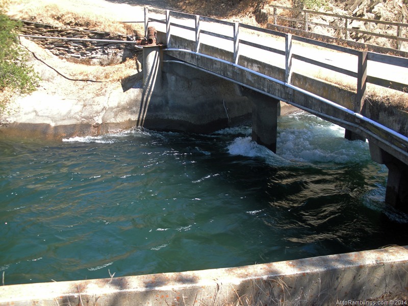
I had to cross an old bridge to finish patrolling the backcountry.

Here is where the real off roading began. Getting equipment and materials in here can be a bit of a challenge especially in wet weather. A cat had cut the trail prior to my visit.


New Don Pedro Dam off in the distance.

In 1997 we had what was called the flood of a century. For the first time flood gates were open and it cut this swath through the mountain range.


This poor image shows the water flowing into the Tuolumne River diverted around Don Pedro dam. There had to be some good gold washed down here into the river.

Looking into the central valley.

The trail breaks out onto a high plain. A few years back I saw a 6’ rattlesnake here.

The trail runs through a Oak forest.

This is what woodpeckers do to the poles. I’ve been told they store acorns in the poles in hopes of finding insects that eat the acorns later on. A food bank so to speak.
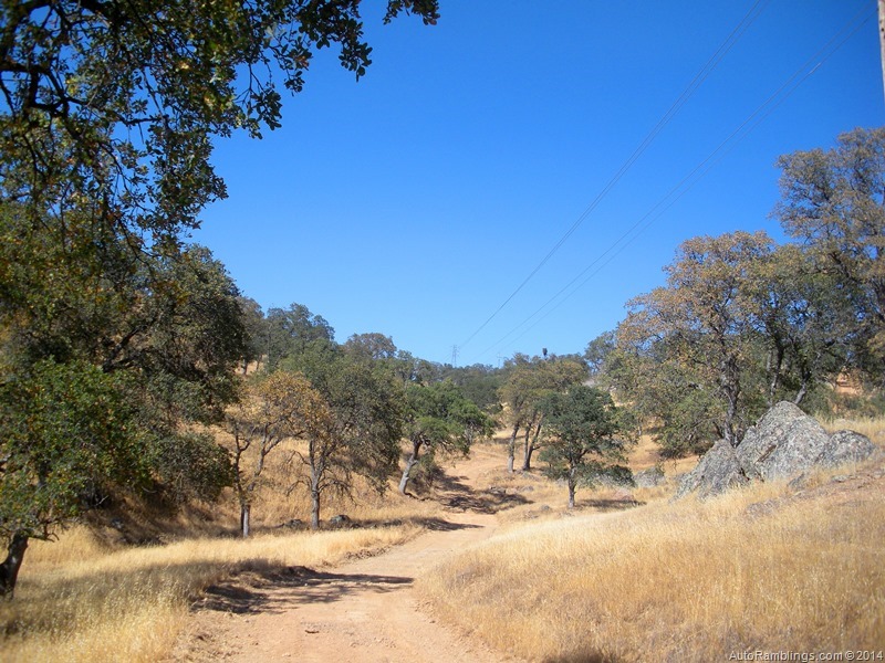
The trail gets a bit more rough as it climbs.

Again, it’s hard to tell from the image but the climb out of Buzzard Gulch is steep and requires four wheel drive.

Damn!

I side walled! And it was a brand new tire. Thankfully it was only one dually. I limped my way out.

Close to Pedro I felt a bit better. Time to call the shop.

Hard to get service like this in the backcountry but if need be they would have met me in there. I was able to make it to the recreation area shop this time. All I was thinking was what if this had been my SMB…sweat city.
By the time the shop made the repairs it was getting late. I didn’t want to patrol at dark. That requires a lot a walking and it was still hot outside. I headed back to lower Dawson Lake and headed back down for the last segment I needed to look at.

The tail race out of the powerhouse shown here is great fishing…er, I’ve been told.

Many sneak in to fish this lake…not me of course.


I thought I found the problem but all looked OK. I could see the heads of the fledglings looking over the nest. We have a lot of Eagles that nest in the area but this was an Osprey nest.

Back on the move.


Nope, not the Devils Tower but kind of looks like a mini version. Actually a gold dredge had moved through the area between the turn of the 20th century and ate up land until the 40’s.

It resides here in a pool of water.

It’s now a historical landmark.
The dredge was wide open back in my youth and while we worked the area rebuilding the transmission lines, we frequented it. Many times I explored what was left from a time long lost. Over the years, parts were removed or scavenged until it was classified as a monument.

The Tuolumne Dredge (similar to a floating barge), worked its way from the Tuolumne River basically creating its own waterway and pond. A dredge spud (usually a pole) was placed in the pond and with the dredge connected to it, the floating barge spun in a semi-circle collecting all the soil then separating the gold from the ground it dug up. After running all the soil, it would move to its next location starting the whole process over again. Leaving tall mounds of river rock behind it, the normal landscape was basically altered for years to come. In fact many areas are still scared today from where this mining machine gobbled up the earth almost three quarters of a century ago. Today the some of the tailings left behind are processed to make a variety of gravel and aggregate materials.
Back on the trail the sun was slowly setting in the west.


At times this can be an issue crossing but not in a drought year.

This pond which was part of what the dredge tore up is now a haven for wildlife. Who says mankind wrecks everything!

More oak tree area.


Night approaching.


Thankfully I was getting close to the end of the backcountry patrol.


The moon rising.

Gorgeous ending to an off road adventure. I still had about 5 miles of line to run out. In the end I found a Mylar balloon that tangled up on the feeder line in town. Sometimes I hate running out this line but it does have its perks. I drove from LA once when the dispatch called me when I was at Deaver Springs having new spring packs installed. Now that was a long day of driving for sure. 350+ miles of asphalt followed by 50miles of dirt. Why did I answer that phone  The answer is it put a big dent in the price of the spring install,
This job took me 12 hours…all in a days work.
Thanks for following AutoRamblings Sportsmobile 4×4 Adventures.
]]>
High Sierra Sportsmobile Forum Meet June 18th-23rd 2014.
Last year one of the Forum members had shown interest in a small Thanksgiving run that fell through for both of us. Still interested in some kind of rendezvous, Ralleypanam (Robb) contacted me about doing some kind of run after the High Sierra snow melt receded enough where access the upper altitudes was possible. A couple of spots came to mind and I contacted Robb to plan a time & place. Mid June worked for both of us and Leavitt Lake seemed to stand out as a good choice. Normally by July the trail has been opened to the public except during the most snowy winter seasons. Being there has been drought conditions this last winter I figured the Lake would be open earlier in the season due to the low snow pack. In the past the Forest Service usually tries to open by Memorial Day or shortly after.
Normally I would try to pick a camping spot that members without four wheel drive can get to, but unfortunately the Leavitt trail can be a little rough and steep in places. For once this was going to be Forum 4×4 meeting even if it was only me and Robb attending. I put the word out in the meeting/trip report section of the Forum asking anybody interesting in attending were more than welcome. Several members planned to attend; more than I anticipated.
Leavitt Lake:
Just off CA-108 above Sonora, Leavitt is a high Sierra lake that rests above the 9000 foot altitude that I’ve been visiting for over a decade. Considered an Alpine setting, this spot is one of the most beautiful areas in the Sierra Nevada range IMO.
For more info see my Leavitt Lake post from 2010.
The Lake is a fantastic fishing spot as well as a trailhead for the Pacific Crest Trail. It has become an annual event to camp or day fish the lake since before I bought my van in 2006. The roads through the area supply access to a number of dispersed camps and also makes for some easy mountain biking between the camps and beyond. There are a couple of other smaller lakes in the area that are within walking distance. At the lake itself, fires are permitted provided restrictions aren’t in place. There are no facilities or running water at the lake.
When accessing from 395, the city of Bridgeport is fairly close and supplies a limited variety of amenities before heading up the hill to Leavitt. Fuel at Bridgeport can be high priced but all types are available. From 108, Sierra Village has a small store or two and Zak’s has reasonably priced fuel and supplies diesel as well. Sonora on the western slope has the big box and major grocery stores.
The Trip:
After the final invitational post was sent out on the forum, once again I contacted my personal friends to see if any of them wanted to tag along. CellularSteve had just added a newbie to his family and wasn’t able to make it but CalClimber (Craig & Cindy) decided to go. My buddy Don from Merced was ready as usual and has camped with Craig and Cindy on several occasions so not everybody would be new acquaintances. I had also met the Oldbonesclimber clan (Paul & Tina) on a previous trip.
There was a little glitch on the dates. I guess the gate was opened on Memorial Day but it wasn’t the Forest Service that opened it. Because of this they re-closed the area. Pay back? Anyway a week or so before the planned date I got news that it was opened to the public. Whew! Why it hadn’t opened early during a drought was a bit suspicious to me but at least the trip was on.
As it would go, several members showed up.

Ray/Jennifer (1der)

Robb/Jennifer (Rallypanam)

Paul/Tina (Oldbonesclimber)

Eric/Kristie/Sam/Sera (86Scotty) Kristie, Sam, and Sera were hiding in the back but I have more pictures to come.

Jack/Jacqueline (YVRR)

Danh (danhtran1143) pictured on the right.

Craig/Cindy (Calclimber)
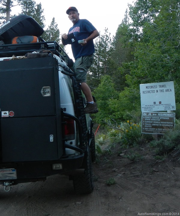
My buddy Don
6/18
Heading up:
The couple of days before leaving out I headed down to Merced to load up Don’s equipment. After leaving his house my front wheel started making noise. Great! Don’s wife has said it more than once… “your van always breaks down???. I think she has a Lego model of my van and sticks needles in it. Thankfully I got it fixed which only lengthened our departure by a day.
The weather in the valley was good and at least the temps were held at bay. I prefer that temps around home are below the 100 mark when leaving out to the mountains, but no matter what, the Sierra temps at Leavitt don’t usually creep above the upper 70’s at night even during the worse heat waves. California central valley temps were currently ranging from the upper 50’s at night and into the low 90’s during the day. I knew it would be cold up there and warned the members to prepare for cool evening temps.
With a late start, we made the pass as the sun was dimming.


Highway 108 is one of California’s gems.
On the trail it was obvious we were here at a good time of the year. It was hard to tell there was any kind of California drought.
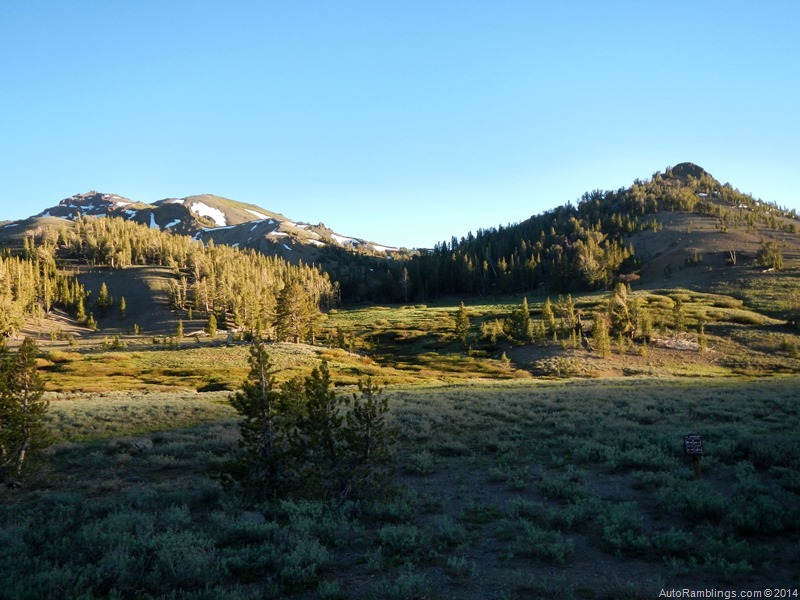


Only a trickle.
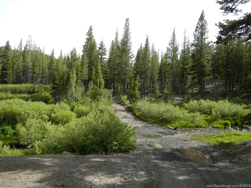
There are three stream crossings, none of which would pose a problem but the crossing pictured above can be an issue during a flash flood or heavy rains that frequent the area.
We made it to the lake and found nobody there. I grabbed the spot I prefer to camp at but there are plenty of premium sites that offer some better views. The place I normally take has some good tree cover that doubles as a wind break. At this time of year I always plan for cooler temps which I always expected for Leavitt. The weather can swing abruptly up there. The week after the meet temperatures soared for a few days then was followed by front that brought in light snow to the region. But the weather was reasonable during our stay with one exception, the wind.
The party was in the van the first night. Don had bought a well-made tent last winter that stood up to the howling winds. Other than the sound of water, wind makes it easier for me to nap over those nights of dead silence, and the wind whipping through the trees made for a pleasant sleep. Oh and the alcohol helped too!
6/19

Don and his tent with the wind barriers around the propane fire in the background. Don knows not to get too close to the growling walls of the SMB. Me snore? Never!
The wind would be heavy throughout the entire trip only to let up on Monday the day we left out. I’ve been in some heavy winds at the lake but never the continuous barrage we were subjected to on this trip. At least the evening temps never fell below 40???.
A few morning pictures below:


It wasn’t long before some of the members rolled in. Ray and Jennifer were first to arrive. As we were talking with Ray, Paul and Tina drove in.

Paul and Tina.
Soon Eric and his clan came arrived from their cross country travel adventure and set up their camp.

Eric’s camp.
We had a little get together that night at my camp which would end up being a nightly event. With wind barriers around camp and with my little propane fire as the only heat producer, we were able to stay somewhat comfortable protected from the wind chill. It would be a fairly short night for all who had arrived, but it was an enjoyable evening especially talking with Eric and hearing about his adventures he had with his family prior to the meet.
Here is Eric’s trip report:
6/20
The next day we visited Eric’s camp.
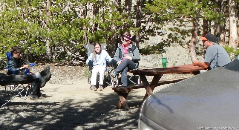
Sam, Sera, and Kristie with Don at the table.

The Lego man.

Don and Ray at Eric’s, the only camp with a table!

Sera, Kristie, and Jennifer coming back from a hike.

Craig and Cindy finally showed up.

Eric, Craig, and Cindy in a heavy discussion about how cold it was. Well I guess only Craig was cold by the looks of it 

Paul and Ray facing the camera.
Several meeting and “bull-sessions??? went on throughout the day but it wasn’t long before Eric and his family had to leave to their next destination. Too bad! Time was moving too quickly and I wished they could have stayed one more night. At least they had time to explore the area before leaving out.
Later that day Jack and Jackie came driving in with Danh right behind them.


Jack & Jackie’s cat.

Dinner with Craig and Cindy was a big hit. The pulled pork and slaw sandwiches were fantastic. Thanks Cindy! It did prep us for the evening.


Cindy, Danh, in front with Craig, Jack and Jackie in the background. Don’s on the right.
Adult beverages flowed that night around the fire that had yet to be lit up. Those little propane fires are nice but really suck up the gas so I waited until the air chilled before lighting it up.
Someone up there was blasting off fireworks. I do realize that there isn’t much to burn at that altitude but the thought of doing such a thing evades me. I mean why? Dumbasses for sure. But hell, we had our own light show going on, and it didn’t pollute!


Cindy had her own set of LED lights that lit up the night. An awesome display!

Robb and Jennifer pulled in late and joined us at the fire.
Jack showed some of the members (via a tablet) his replica of the Yosemite RR that happens to be the most impressive reconstruction model I’ve ever seen. Many of these places have been spots I’ve visited over my youth. Same for Don who grew up in Merced. There are several YouTube videos worth looking at.
One day I want to visit his display. Watching the videos and looking at the pictures I must admit it’s the most realistic display I’ve ever seen. Awesome Jack! Hard to believe how small those models are.

The get together was another hit and I really enjoyed the evening. Robb, Don and I stayed up a little late that night and used up all the propane while exercising our drinking hands.
Another night came to an end but the wind didn’t. At least nothing blew down.
6/21
In the morning Danh reported his engine hadn’t charged up his house on the trip up. So some of us went to take a look and Paul noticed Danh had a visitor during the night.

Hard to see but in the lower left of Danh’s window is what looks like a small bear paw. Not that there aren’t bears in the area, but I’ve never seen one up there. Imagine waking from a dead sleep to that face in the window 

Checking out Danh’s van.
I had to go back to grab some propane so a trip to the store was in order but not before we stopped and grabbed a pizza with a pitcher of beer on the side at Mia’s. There was a bit of World Cup mania going on inside but not too crowded.

Mia’s is located in Cold Springs on the west slope and puts out great pizza, sandwiches, and Italian food. At times it can be packed when the locals along with people staying at the Pinecrest Lake resort and campers show up at the same time. It’s probably the best restaurant in the Pinecrest area. It’s a bit of a drive from Leavitt…but beer on tap is worth the trek.
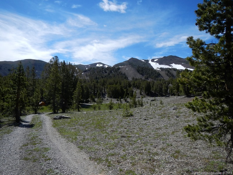
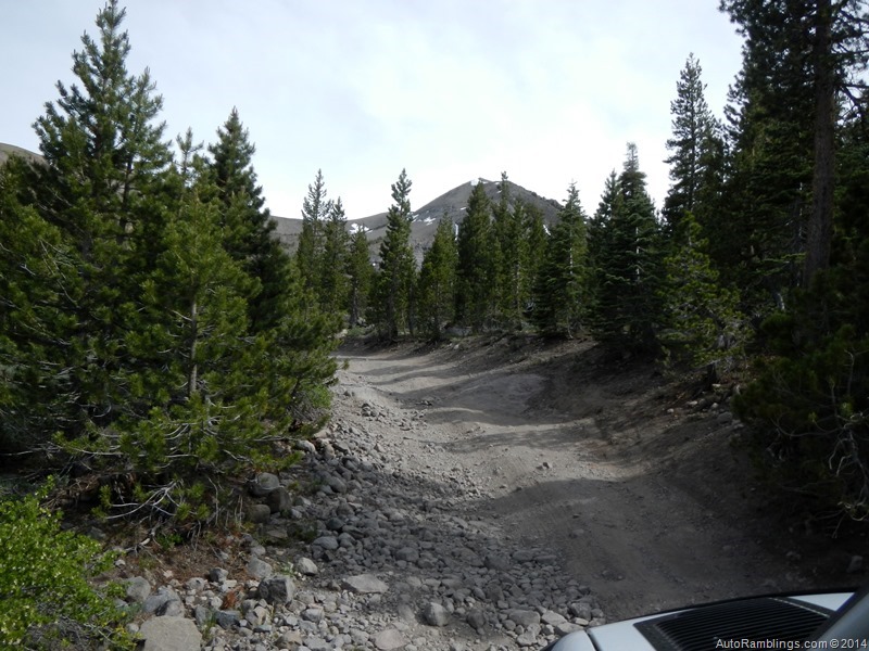
After grabbing some propane at Zak’s and the electrical parts for Danh’s van (Zak’s is also the nearest NAPA parts store) in Sierra Village, we headed back to camp. On the way in we shot a few pics of the trail.
(Click on images to zoom up)






Back at the lake we drove up to Robb and Ray’s camp. The wind was still a factor.

Everybody was talking about the hikes they had done during the day and it sounded impressive. The only thing me and Don could talked about was how good the pizza and beer was.
We did get Danh’s electrical issue repaired before the evening rolled in. We had another meet up at my van, and there was a lot of laughing going on. Another great night.

Robb, Jennifer, Jackie and Jack.

Me, Paul, Tina and Danh.

Cindy, Craig and Ray.


Jennifer with a smile Robb with a soda…just kidding, a beer!


Ray and Robb. A standard San Francisco Giants fan.
We were havin Damn Good Times
At one point all the members showed up to hunker down behind the wind breaks. Yeah the wind never did seem to stop and neither did the fireworks. Those guys were blasting off mortar sized rockets. At least they stopped so everybody could get some sleep after the party was over. Definitely a night to remember.
6/22
Danh left out in the early morning hours. I wish he would have stayed around a little longer. I’m sure he’ll want to do another run one of these days. Don and I had our usual “Hair of the Dog??? espresso blend during mid-morning to kick the hangover’s ass. It was now Sunday and most of the members were planning to head home. It was time for a group shot.


OK back to talkin about our rides.


No dog & cat fights.


Some members just kicked back.
After most of the members left out, Don and I took in a 4×4 run. Robb &Jennifer, and Ray & Jennifer stayed to do some more exploring and just kicking back to enjoy the area. We took off to once again see the other side of 108 which would be an eye opener for me and not really a good one.
I’ve written about the Wolf & Silver Creek run on my web site. I’m not going to go into much detail except to say that the Forest Service has closed several trails in the area. It’s still not a bad run but some of the places I used to camp at are now off limits.
A few pictures from the run:

There is a lot of “above tree line??? terrain and luckily a few flowers were out.


I guess you could just pull off the trail to camp in a pinch.


The views are rewarding.


A few gorgeous views of meadows.


The sign said “Pride in America??? like that was supposed to make me feel patriotic about the government closing public lands to us. As if re-routing the trail isn’t possible? Some of the trail closures made no sense at all, but a few like ones running through meadows did. I want to conserve our lands if need be. Yet you can’t tell me that trails can’t be routed around the meadows.

Some of the trails that had no places to camp at were left open.

This one ended in a dead end and was very narrow. We were forced into a multi point turn around.

Hum… what is 7 tons?
I think this might be a Marine camp. It was a really nice place place to boon dock at.

Well, I’m not 14,000 pounds yet!
We headed down towards the Marine Base at Pickle Meadows. Time was getting short and we wanted to get back to the lake before dark.

Another nice meadow which actually had some camping nearby.

Pickle Meadows
We got back to camp before dark. Ray and Jennifer had cooked up a homemade pizza that was better than Mia’s. It was the last night around the fire and I was surprised that the propane tank was low again. But we kept the flame low and it lasted for the night…just like the wind.
6/23
In the morning we had a real breakfast…Sausage and Egg McMuffins with plenty of Espresso on hand.

Don cooked up the sausage and muffins while I took care of the eggs and espresso inside the van.
After breakfast we broke camp and prepared to head home. Finally the wind had almost completely quit. Yep, right as we were about to leave.

The rangers showed up and told us how they busted the guys shooting off fireworks. They also told us that they are closing off all the camping on the southeast part of the lake. Hum…they closed off the northwest section a few years back. I wonder how soon they will close off the northeast section leaving people with no camping at Leavitt?
Rant warning!
There seems to be a push to close this area off to vehicle traffic due to the endangered species act. I’m not happy about this and plan to do what it takes to keep the trail open to camping and vehicle use. The chances of winning against the Government are slim and are reasons to visit these areas as much as possible before it’s closed. It will be a sad day when I can’t take friends and family members to see our wonderful backcountry that is supposed to be ours. For the thousands of acres that are not accessible to vehicle traffic, I don’t understand why the few spots that have been open since the 1940’s (or earlier) should be closed. The forest is vast and there is so much land reserved as non-vehicle use, I’m against most closures. The closure is not specific to this area but practically the entire Sierra Nevada range in Northern and Central California. But like fishermen and hunters, off roaders are considered a minority group, and not politically correct. I guess I should be happy for what I’ve seen in my lifetime. It’s time to contact the politicians who support keeping the backcountry open to vehicle traffic and tell them to introduce a common sense approach to accessing our public lands.
A last group shot before leaving out was in order.

Nice picture Jennifer.
Time to go.


That’s not wheel hop, Ray’s van is not moving in this picture.


Robb made it look easy.


Robb hauled out garbage left by some Jerks. Some people do care and is why much of the backcountry isn’t loaded with trash.

Unlocking the hubs…time to hit the highway.
After leaving out of the Leavitt trail we did take another trail located not too far away. For whatever reason I lost those pictures  We had a good end to the trip but unfortunately some of us had to head home. Ray and Jennifer stayed another night but work was calling out to me in a voice I really didn’t want to hear. Argh. It’s always the worst part of any trip but there is always the next meet or adventure to look forward to.
Summary:
This trip was a hit. It was great meeting people in person I’ve only typed at. It’s times like these that make life long friends. Other that the wind, the weather was great. But the wind did keep the mosquitos at bay so we did get some good out of it. I do wish the group could have stayed together a bit longer but I wouldn’t trade this excursion for anything. Thanks to all the members who showed up. We’ll have to do it again.
Please tread lightly, respect the backcountry, and other who occupy the trail.
Thanks for following AutoRamblings Sportsmobile 4×4 Adventures. Hope to see ya on the trail.

Dedicated to my long time friend Thomas (Wade) Cockrell who shared the same passions of fishing and backcountry adventures of the High Sierra’s.
Over the years we explored miles of remote areas while backpacking and camping above California’s Central Valley. He enjoyed the beauty of Sonora Pass and especially Waterhouse & Leavitt Lake.
He will be missed.
]]>
Trails during a drought year.
2013 was a very dry year in California. Although autumn didn’t produce the normal light rain activity that commonly hits between September and November, we did have an unusually cold December with higher than average precipitation that dumped snow at very low levels.

It looked like the winter season would be a wet one, but it didn’t turn out that way. After Christmas, the month of January 2014 turned out to be one of the driest on record and the December 2013 snows just didn’t pack enough of a punch to make a huge difference. Not that drought is a surprise in our area; we usually get a few years of extremely dry conditions about every 10 years or so. There are those rare years that the upper elevations of Yosemite are practically void of any snow during early winter and the National Park Service keeps the Tioga Pass highway open. If you ever get the chance to visit Tenaya Lake or Tuolumne Meadows during December or January you need to jump at the opportunity. Even though the pass stayed close this year as usual, January was the warmest I’ve ever seen and all but the highest altitudes were void of snow. It set the tone for early winter travel… hit the trails before the rain and snow returns and closes them.
I did a couple of runs above the community of Coulterville by myself during mid January and it was unusual to see fire restrictions in effect after the December storms. Generally you don’t need a fire permit until March but I thought it would be a good idea to grab one. Everybody has been on pins and needles since the Rim Fire took its toll last fall. The forest fire was huge and it destroyed several places I camp at.

During my December visit I wasn’t too happy seeing the destruction caused by the fire.

It’s going to be interesting this summer when everybody will be packed into what areas are still accessible.
I had been in touch with my buddy Steve over the holidays and he made it clear that he wanted to do some kind of trip before March. Being it was so dry up here we tried to work in some dates during February to do a 4×4 run around Yosemite. In late January and early February we finally had a few storms move through and the dry spell was broken. I worried that the forest service would close what trails were open but the ground really sucked up the water and it did help finally turn the hills green. So the trip was set and it looked like the weather was going to cooperate. I got in contact with my buddy Don to see if he was willing to come along and he was up to it. Every year we get together for a late winter rendezvous and it looked like this would be our annual 2014 trip.
This was a short trip… only 4 days. The plan was to set up a base camp and take a couple of trails close to the site. The campsite would be around Anderson Flat close to the Old Coulterville Trail. It’s a spot I’ve camped at since the 1970’s.
The Trip:
Most of this area was new to Steve except the Briceberg road. I E-mailed him directions on how to get to base camp after confirming the date. State route 132 is the main road into the area and passes through Coulterville. The Anderson Flat area can be found by clicking on the link below as well as the other spots we visited.
Anderson Flat (Map link)
Dogtown Road (Map link)
Schilling Road (Map link)
Texas Hill.
Burma Grade also called Briceberg Road.
Fuel and supplies:
There are several places to fuel up in the general area but one of the better stores is located in Greeley Hill. It is a fairly large market and has fuel including diesel.
Off to the hills:
Don drove up to my place and we left out late Thursday bound for camp but our first stop was a restaurant called the The Lumberyard.


This place is a local hangout around Lake Don Pedro and is located in the foothills between the towns of La Grange and Coulterville. It’s a bar that has live bands from time to time but they also put out some good BBQ food whenever they’re open. The food is plain old homemade stuff. Linguicia and Tri-Tip sandwiches, burritos, and quesadillas, are great but their burgers are huge.
After chowing down a fantastic grilled chicken breast club style sandwich (that actually resembled their huge burger) along with an order of onion rings…oh yeah and a quart draft to wash the sandwich down, we were finally off to camp.

The sun was setting fast. We had an hour drive but Steve didn’t leave out of LA until noon and was hoping to make camp by 10PM. Thankfully nobody else was in camp. There just isn’t a whole lot of room where we wanted to set up at due to how small the camp is. On top of heading into a small camp I noticed on my last trip up there that the Forest Service blocked off a major section of the campground. That didn’t make me happy at all. If the forest service keeps going the way it is now it won’t be long before there will be virtually no dispersed camping available for the public. After setting up, we finally got a fire going. I left a marker light at the road to point Steve in our direction.

Steve pulled in exactly on time. It was good to see him again and after he set up his van we finished out the night sitting around the campfire. This time I brought my trailer full of wood.

Time to break out the adult beverages and enjoy the night.


It was a long drive for Steve. The fact was we were all tired. It didn’t take much to knock any of us out for the night but Steve fell quickly into the abyss yet he NEVER dropped his cigar.
Friday:
In the morning we didn’t get up until about 8AM. The morning was brisk but not too cold.


After the espresso ritual and a light breakfast, we left out for our first run to just grab some firewood.

The best spot for wood was fairly close to camp off a spur road I have never been on before but Don had been there often. Although short, it is a cool little run and provided the weather is clear, the views can be spectacular. We had semi-clear views on this outing.


The previous rains from earlier had left some mud holes.

After grabbing up our bounty of wood, we returned to camp to unload, grab a brew and set out on our trip to Schelling and Dogtown road. Much of the drive to our destination backtracked along the road into camp, so some of it was paved. Don rode with Steve during most of the runs. The first part of the trip would take us over a fork of the Merced River, a crossing that can be difficult to ford during wet weather. We knew this year there wouldn’t be any issues so we headed out.


Moore Creek bridge below.

Moore Creek road (a spur off this road) once offered several places to camp at along the creek. No Longer! The forest service has closed off most of the spots over the last couple of years and have not relocated or opened any other camping spots. People had camped here since the beginning of the 20th century. The spots were fairly clean considering how well used they were and it bothers me that the camps were closed down.
Soon we turned left on to Dogtown Road which can be seen on the left in the picture below. The road splits off and climbs quickly.

Dogtown can be considered an extension of the Old Coulterville road and is a direct route to the town of Coulterville.

The road is not maintained during winter and can be slick in spots during and after rain.

Another feature of Dogtown as mentioned earlier is crossing a few creeks including a fork of the Merced River.

There are times that I can’t get across this section in my van when the water is high. But the drought curbed the wild waters to a trickle during this visit. Below is the second crossing that isn’t near as deep during high water.


The road becomes a paved route that winds its way through a residential zone. This section has several cabins and ranches, some of which are very nice.

A Valentine left over from a few days back.


After crossing through a backcountry residential area, the road splits where Dog Town and Schilling rendezvous at. Not far down the road the pavement finally ends.

Schilling Road is a foothill route that drops in elevation to CA Highway 49, an old 49er trail of the past 1800’s. I wrote about this route a few years back in my post the Old Coulterville Trail and clicking on the link will provide more information.

More of a trail, Schelling Rd travels through open cattle range country and is usually passable except during wet weather when the road is slick. Because it is cattle country, a series of gates are usually closed.

It’s important to keep the gates closed for obvious reason while traveling the route. Permissible access through open range cattle country is becoming more and more limited as roads like these are being closed to the public.

It’s important to understand you’re driving through private property so stay on the main road even if you see a side trail.

Veering off the road is trespassing and is handled as such. It’s common to see a bull from time to time but although generally passive just be aware what an angry bull can do, so avoid them when possible.
Much of the run follows a ridge before dropping in altitude.


You can get the feel of the old west driving through the region which can be a treat for those who have had limited experiences traveling in this type terrain.


Because of the drought this year, grasses were slow to grow and grazing was limited for ranch owners so almost all of the gates were open on our adventure due to the lack of cattle.


Although this is a county road, a picture of my van on this road was featured in the summer 2013 Expedition Portal Overland Journal Sportsmobile ad proving it’s a very scenic springtime run that appears to be a remote area. Because of the gates it actually is. Most people turn around when approaching a closed gate.


In some spots you can grab a glimpse of Half Dome along the route, but the scenic greenery of the lower foothills is often unmatched with or without Half Dome in the background.

(A close up of Half Dome)

We pulled over at a nice spot close to a big oak tree.

After taking a few pictures I noticed the rear driver tire was low. Later I was to find that the rim was defective. Thankfully I had an on-board air compressor.
The views are classic foothill vistas of the California gold rush areas. It’s hard to believe that thousands of people occupied these hills during the 1849 gold rush.

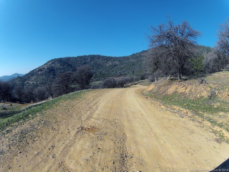

Towards the end of the road you pass through a ranch.


After passing through the ranch, it’s backcountry until highway 49.


A couple of trail thugs told me not to mess with the locals or I might not ever be heard from again. Heeding their words I stuck to the trail. Who would screw from such serious faces like these?
After hitting Highway 49 we zipped into Coulterville.
Steve had passed through town on the way up but it was dark so we made a pit stop.

In the past the bar did put out some great food but rather than pay bar prices for food and drink we decided to head back to camp. It was a very tough decision to pass up the bar.

There were plenty of people about and I always get a chuckle from the looks when 2 or more Sportsmobile’s come into a small town. Seems we always get looks like the Government is in town especially when the vans are the same color.

We saw a suspicious tourist hanging around town and decided to avoid the guy. Don said he looked like the kind of guy that might come out of LA.

Coulterville has a bit to offer as a gold rush town.

On the way out of town I took Steve by some of the older buildings in the area.


Things go better with Coke?


That LA dude seemed to be following us.
This building is one of the oldest in town and a historical spot many stop to see.

The sign says it all.
After our short visit we were off to complete the section of Dogtown that we had passed up to take Schilling. Some of this route can be very scenic during a good springtime flower bloom but we were a little early for that. No big deal, it was still a nice Sunday drive even though it wasn’t Sunday.

Part of the road follows along and crosses Maxwell Creek which runs through Coulterville. The town of Coulterville was actually called Maxwell’s Creek in its early history.
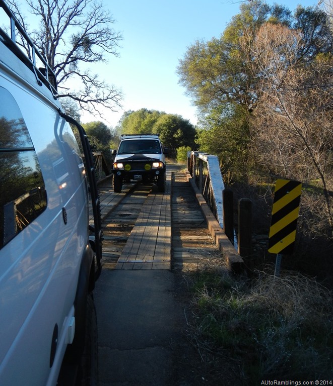


The sun was setting so the trip was thrown into high gear.

I did have time to take a picture of one homestead sites along the route. Again for more info on this road you can read my post on this site, “The Old Coulterville Trail???.
After completing Dogtown we headed to the store at Greeley Hill for some ice and then back to camp. Another night around the campfire was great as usual but it did tell us we needed to restock the wood supply the next day. My mom’s famous meatloaf slider burgers with English Muffins hit the spot for dinner along with a variety of standard finger foods. As usual Don supplied high quality cigars and coupling a few Rocky Patel’s with some good whiskey and Vodka, times were good. There was a lot a classic music and laughter. This night led well into the next morning… can we say hangover generator!
Saturday:
Ok the morning was a bit rough but there was no reason to get up too early. This would be our layover day. Espresso did its job and it was a mellow day.
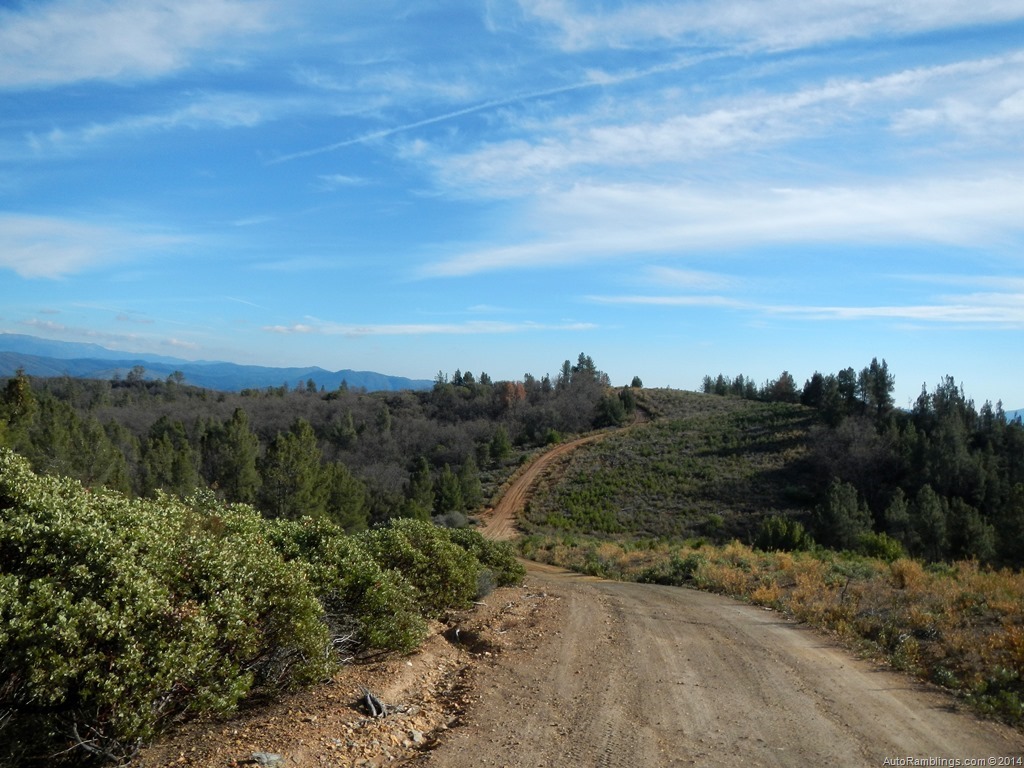
Don had shown us where to find an abundant supply of wood and I brought along a few weapons to do some target shooting. There are a few good spots around Texas Hill to do some trap shooting and what not.
After picking up some wood, Steve got to try out his brand new Sven saw. I’ve had one of these things since the early 70’s and still carry it today. Other than a chainsaw, I think it’s one of the best items to keep aboard.

The sun was setting around the Texas Hill area by the time we wrapped up our wood cutting session.
The fire was going to be unstoppable this night.

Again the drinks flowed as the music echoed up the canyon, and our laughter was so loud it was lucky nobody was close by.

We fired up the BBQ to tamed our growling stomachs.

Same as our last adventure less than a year ago, we were the three amigos once again. Sometimes things just click. Don brought some killer finger food that cooked up well in the BBQ and Steve had some Asian ribs that hit the spot. We actually had too much grub with us once again.
The day was rough… wood chopping took the best out of us so the evening came earlier than normal… well for one of us at least.

Still we were all tired. This was our last night and we all made a break for the sack earlier than the night before.
Sunday:
Morning came, the coffee was brewed and we prepared to head home.

We had enough wood to sit around a morning fire before leaving out. We also cooked up a few goodies that we had left over from the night before.

No these are not gray chicken wings, rather stuffed spinach wraps that tasted way better than they looked.


A little hair of the dog? No way… it almost made me sick thinking of it.
We had enough time to take one last trail. We set out toward the Texas Hill Trail.
(Click on smaller images to enlarge)


The trail is were we had gathered wood the day before and starts where a section of private land occupies a large meadow area. The Trail was wet in sections but we knew from the previous days we were in there that the mud holes had a good solid bottom. We didn’t need to lock the hubs. In the lower right picture above as well as the lower left, you can see why we gathered wood here…it was everywhere.


Some of the mud holes weren’t exactly shallow.


Steve and Don kept in touch via radio and lagged back due to the dust I left behind me.

Texas Hill is in the picture above and below.


Much of this area is thick in low level shrub brush.


Fire had ran through this region several times over the past years destroying most of the tall trees. Sometimes fire can make things better but it also can ruin the scenery.


A small creek runs through this area and can pose a problem in wet weather.


These ruts may not look deep but they were. Heavy rains can make this simple trail more complex.

Yosemite Valley in the background.

Outstanding views of Half Dome.
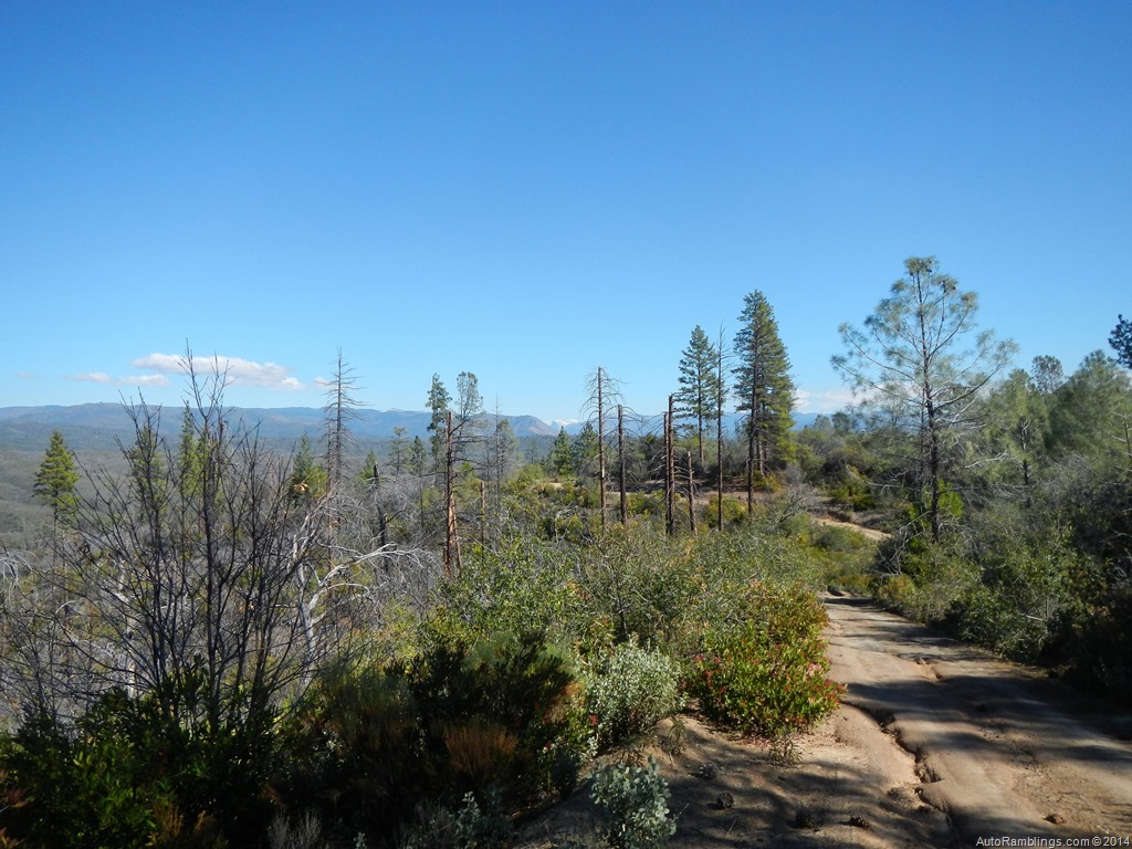
This was the crest of the trail and in general it was all down hill from here.


The forest began to thicken where fires had left less of an impact.


It’s difficult to see in this sun blinding image but a tree had fell across the trail. This is common after a storm has passed through. No big deal unless you have a trailer and need to backup.

Finally the trail crosses the Burma Grade trail. From here we turned right heading toward Briceburg.

Steve, turn right Steve!
The Burma Grade Road, also know as Briceburg Road, is a trail I’ve taken and written about so many times that I wonder why I’m even posting about it here.

Well, here it is but I’m not posting much about the run.


The trail winds its way along a gradually down sloping grade that runs along an impressive mountain shelf. From here some of the best vistas in the area are visible.
I can take (and often do) this route home rather than expose myself to the dull boredom of highway 140.

Briceburg and the Briceburg bridge below.


The end of the trail was right around the corner.

The Merced River below Yosemite and El Portal.
We finally made it to the Briceburg Bridge. It had been another asskickin trip and was time to say goodbye.
But not before one last beer.
THE LAST BREW

Steve on his way out toward LA.
It was also time for me to head for the barn and although I would rather have stayed a few more days, work on Monday trumped vacation. Every time I leave for home I think what it would be like to be retired and just travel from week to week with nothing hanging over my head. It must be nice but I’m sure another vacation trip is just around the corner. I’m looking forward to my next trip with Don and Steve. Get out and enjoy the backcountry.
Thanks for following AutoRamblings Sportsmobile 4×4 Adventures.
*** Washington bureaucrats are closing more and more public lands to specific uses. Their latest objective has been the enactment of the Motor Vehicle Use Maps or MVUM. Coming from a backpacking upbringing, I’ve always respected nature. Nothing used to upset me more than someone in or on a motor vehicle dusting me out while I was backpacking. Lately I’ve even seen some out of control mountain bikers with poor trail habits. I support the Tread Lightly theme and drive using proper Trail Etiquette. Unfortunately there are still plenty of those out there who fail to respect nature or other people using the backcountry. There’s nothing worse than a person creating havoc with a motorized vehicle and it’s a sure way to give the sport a black eye. It also gives the government the necessary ammo to implement trail closures via the MVUM. The Feds claim they have opened and secured lands but in many cases what they’re doing is closing off areas to all but foot traffic. What about the people who don’t backpack anymore? Just like water, public lands belong to the people not the government. I have issues when vehicle trails are closed, off road parks for motor sports shutdown, and campgrounds constricted, but my biggest concern is the closure of dispersed camping spots. IMO every boondock spot closed due to the MVUM should be at least be relocated. The Forest Service should be opening more campgrounds and areas to disperse camp as well as rerouting trails around what is considered fragile areas, not eliminating them. It’s an uncomfortable trend of total government control without regard to our individual liberties. Please support keeping our backcountry vehicle access open to the public and always TREAD LIGHTLY.
]]>
By Dave Boyer
2012-2014
In the lower US there are a handful of exceptional off road trails that stand out in the expedition world. The Mojave Trail located in the Southern California runs through a section of the 1.6 million acre Mojave National Preserve and is considered by some as a premium off road route. It also draws visitors from outside California including those from other countries who wish to “overland??? portions of America. The trail is longer than average and although it crosses a few minor roadways, much of the landscape is remote in nature. Several sections remain as it was in the past…much of it like it has been for over a hundred of years. Because of the trails old west history, I’ve always wanted to run this route.

Also called the Old Government Road, most of what can be traveled today is based off an old Infantry supply route, but over the years some sections have been diverted from the original wagon trail. The total mileage is about 130+ miles long and can be done in 3 or 4 days. Just take into consideration that there are sections both on and off the trail that can be explored which might require extra time on your part. Although considered an off road trail, most any standard four wheel drive SUV should be able to navigate the majority of the terrain, weather permitting. It’s important to note that any 4×4 trail is subject to change. A brief heavy downpour of rain can make some trails impassable in a short period of time and it’s no different on this route. Besides the possibility of rain causing problems, blowing sand, extremely high temperatures and even snow can turn this mild trail into a difficult passage. It’s always best to call about the condition before attempting it. Be aware that there are portions of the trail that might require specialized equipment that doesn’t come stock with the average factory equipped SUV. Correct tires and recovery equipment along with the knowledge of how to use these items may be crucial in making it through some of the tougher sections. Most of the difficult parts of the trail can be bypassed but there are no warning telling you what’s ahead. Another issue can be cactus such as the Teddybear Cholla. These little spiny plants can puncture the sidewall of your tire and ruin your trip. A good spare, a compressor, tire repair kit, and a can of flat repair is worth having on board. Basically the phrase is be prepared for desert travel.
Amenities:
Because the route crosses several well maintained roads, getting off the trail for supplies is fairly easy. The best plan is to be fully loaded with spare fuel on hand to get you out of a jam if required. My biggest issue is usually running out of ice, propane or firewood, and lastly diesel. Starting from the east, Needles has everything required to prep for the run. After that Bullhead City, Searchlight and finally Baker on the western end can supply what you need if you run low on something. Palm Garden Chevron close to the start of the trail at 163 & 95 has diesel and a small food mart. The local towns require a 20+ mile trek depending on where you leave the trail. Baker lacks larger grocery stores and is just a pit stop along I-15 but they have fuel, food, ice and propane. A-1 All Night Services located in town at 72572 Baker Blvd not only has propane but also is a tire shop and tow service. (760) 733-4380. They will pull you out but I don’t know at what price or how far they will go. I generally make contact with the local services before I need them. It’s just an added bit of security. It’s possible there are other smaller stops that have fuel such as Primm N/O the preserve and Fenner off 40 thirty seven miles W/O Needles but the others mentioned have the major shops. Call ahead to make sure diesel is available at the smaller gas stations.
History:
Partially based off an ancient Indian trail, the original foot path wandered through a dry desert region that generally required water to survive the trek. For hundreds of years Indians knew the location of watering holes along the route which allowed them to travel from the Colorado River to the Pacific Ocean. According to historians, the original route was much longer than what’s left today, and some say it once reached from San Pedro California to Prescott Arizona. The path was also used by early American explorers, missionaries, pioneers, and immigrants between the 18th and 19th centuries. Father Francisco Garcés who gave the Colorado River its name was probably the first non-native visitor to traverse the Mojave trail in 1776, but it wouldn’t be until 1826 when the first American explorer Jedidiah Smith traveled the route. During Smith’s expedition, he used two Mojave Indians as guides to reach Spanish Missions on the coast. After California was annexed as part of the United States, it was the US military that exploited the trail between 1848 and 1871 converting it into a well-used wagon trail. Fort Mojave was established southwest of Bullhead City Arizona along the Colorado River in 1859. In 1860 the army founded a second outpost titled Camp Cady which was put in service a few miles north-east of the present day community of Newberry Springs. The trail connected the two Army posts and was generally used by military personnel as a supply route. Indians not only resisted the intrusion of the army but also the settlers using the trail that passed through their homeland. It became necessary for soldiers to routinely patrol the route to help protect travelers against the tribes who molested the pioneers attempting to colonize the west. Several minor outposts were established between Fort Mojave and Camp Cady. Most of these smaller infantry camps were located where water was found which also provided a stopping point during a full days ride. One of these was Fort Piute. Still accessible today, it makes for one of the interesting stops along the trail. Of course everybody knows who finally won during the conquest of the west and over the years the Indians were held at bay under what some think of as questionable means. Moving into the 20th century the Army outposts were no longer needed and eventually abandoned but the trail remained. There are only a handful of original wagon trails in the United States that have been left as intact as the Mojave Trail is today.
December 2012:
In late December of 2012, I talked my buddy Don in doing the Mojave Trail. We tried to get a few other buddies with vans to do the run but it’s kind of hard to get any kind of commitment between Christmas and the New Year holiday. So it would be a one vehicle trip and although it would have been nice to have company I was still eager to explore the region. I drove down to Merced to pick up my buddy Don and we were on our way.
Rather than starting from the traditional end at the Colorado River, the western section was chosen as the starting point. This was due to time restraints only. The plan was to drive the short distance through the Manix Wash into the Mojave Wash and on to Afton Canyon campground for the night.

This map gives you an idea where the trail starts in relationship to Barstow and Baker. Camp Cady was close by but wasn’t on the list to visit. Apparently there is some kind of plaque at the site and I’d like to check it out one of these days.
Although the start of the Mojave Trail off highway 15 isn’t part of the original government path, the beginning of the route heading into the Manix wash was easy going.


There are a few trails that split off the main path at the starting point but the Manix/Mojave route is well marked and follows a transmission line for a slight distance. (Click on map to enlarge)


The letter designation “AC??? stands for Afton Canyon. About the only time you’ll see these markers are at a few sections where other trails intersect.

I wouldn’t say the terrain was ugly but an average rating for scenery might fit.

The trail west of Afton Canyon has some of the finest grit sand I’ve ever encountered and the last thing I was wanting to do was to stop and get stuck just to snap a picture. I got this fuzzy shot on the run. You can see all the bike trails in the sand. The wash is wide in spots and with so many tracks running in all directions I didn’t know what side of the wash to drive on. I just picked what looked like the best track but some were dead ends for large vehicles.
I didn’t like traveling it by myself, and burying my van was on my mind while running through both washes. Mud terrain tires are not the best choice and after we hit heavy sand I found out my front locker was out. The sand was so deep that I was leery of even stopping to air down. The mantra was “go, go, go???. Because flash floods move through the wash during heavy rains, the trail changes radically during the wet season. But this year was very dry and the rangers claimed this caused the sand to be deeper than normal and unusually fine. Heavy off road traffic didn’t help either. Having to stop and look for the correct path was a bit nerve racking but we did the run without ever sinking my rig. This is not the place for the newbie off roader with a stock 4×4. Correct tires and the recovery equipment discussed earlier should be considered standard on board gear while running this portion of the trail.

I was somewhat relieved to finally make it to the railroad signal lines where the trail greatly improved but what lay ahead was still a mystery. As the sun set I was looking forward to the end of the trail. Generally I enjoy running at night but with trails running all over the place I didn’t want to veer off the main route. Finally we reached Afton Canyon.
I was surprised to see water in the Mojave River.


One thing that freaked me out were the low lines. I noticed that there was a two wire circuit on the top arm configured as a high voltage line and my antenna was very close to contact. Although nothing touched, next time I’ll tie back the antenna.
Soon we reached the underpass and knew the campground was right around the corner.

Afton Canyon campground looked awful from what we could see in the dark but it did in a pinch. I was just happy to relax on hard ground.


We kicked back, had a smoke, a few drinks, and made some dinner. The big discussion was about whether we should head to the opposite end of the trail and start from the Colorado River or continue from Afton CG. Feeling exhausted we crashed fairly early. After lights out, the sound of a train rumbling by woke me up. For what ever reason I thought it was cool. The engine never let off a blast of its horn as it slowly snaked its way by the camp making an eerie creaking sound. I wished I would have taken a picture but it would of required a tripod and all I wanted was to grab some more Z’s. Looking outside just before sunrise I saw the plans we had discussed were going to be trashed. During the early morning the rains had came in. Great, what would be next?
The rising sun shed light on what we had driven into the night before. We grabbed some coffee and grub while talking about what effect the rains would have, then had a look around camp.


Not the most scenic spot I’ve ever been in. At least there wasn’t anybody around during our visit.

I wasn’t too thrilled about finishing the trail not knowing its condition after the rain. Being Don stays in a tent it didn’t help things either and the weather forecast showed more storms approaching. Sure, a little water helps driving in sand but we both knew about the Soda Lake. Terrain like that can become slippery and clogs your tires. I would have had a different view if I was traveling with other vehicles. My goal was to do the complete trail, not sections of it. Disappointed, the trip was re-evaluated.

The world was supposed to end in December of 2012 but all that ended for us was finishing the Mojave Trail. We would have to wait until the next year and hope for a good weather window.
Fast forward to December 2013:
I always try to grab as much time off from work during the holidays. In the past I’ve set up trips during the New Year which is my favorite time to visit the desert. We had an unusually dry winter in California especially down south. Timing couldn’t have been better for finishing the Mojave Trail. Don cleared the trip with his wife and we planned for the second attempt at finishing the 130 mile off road trek.
I hit Merced about 10 AM and picked up Don. With Don’s wife standing at the front door waving goodbye and tears flowing, we drove off down the… Umm…it didn’t actually go that way! She probably wondered if my Ford 6.0 was going to break down again. She claimed every time we go something breaks and to tell the truth that was in the back of my mind as well. We headed out of central California bound for Needles and the beginning of the Mojave Trail. Because of a late start, Needles was out of the loop so we decided to grab a campsite outside of Barstow along Mule Canyon Road close to the Calico Ghost Town. This place is a dirt biker’s paradise which was definitely apparent upon arrival. The place was packed and although we found a private spot, it was next to the road that was active most of the night. The dust was more of an issue and after numerous vehicles passed by over the hours I came to the conclusion that Afton Canyon campground might have been a better choice. One idiot started doing donuts at the entrance of our camp during the evening. Jerk!
In the morning I was surprised to see how trashed out this place was. The Mule Train road itself was quite scenic but I doubt I’ll ever come back here to camp.

Being it was fairly early, a drive up the canyon was worth pursuing. Was it possible that one unique camp could be found just around the corner? Nope, just more campers, trailers and huge toy haulers occupying any spot available.

The trail looped back close to the starting point but pushed for time it was faster to turn around and returned the way we came in. Several vehicles were coming in for the New Year holiday and I can say I was happy to leave this area.
Barstow was next on the list for some morning breakfast and diesel. I was surprised that a town of this size didn’t provide a good restaurant but maybe that hole in the wall greasy spoon was just hiding from us.

This place was bad; worse than Denny’s even though that might be hard to believe.
After leaving Barstow, Highway 40 took us to the trail’s starting point. I noticed that along side of the highway, the old Route 66 path paralleled 40. It would have been great to have the time to drive the old highway but the day was short. My vehicle map showed the Bagdad Café which triggered a memory from the past but I couldn’t put my finger on it…perhaps a place Huell Howser visited once. A quick visit to Bing revealed a movie was made there in the past but I didn’t recall ever seeing it.

I’ll admit the Highway 40 drive was a bit tedious and seemed like it took forever.
I guess I was experiencing that “are we there yet??? feeling. Finally Needles was within out grasp. After fueling up and grabbing some junk food it was time to head toward the Colorado River and the start of the Mojave Trail.

Along the way, farmland dotted the land providing scenery which was slightly pleasant to the eye.
Finding the start of the trail was somewhat more challenging that I thought it would be.

We found numerous roads that led to the river. There was also a newly built Indian gaming casino close by where the original trail started that wasn’t on the map.

We finally figured it out and even though it might be trespassing to get to the river, I turned into a field toward the bank of the Colorado to pick up our rock.

(Don’s chunk of the Colorado)
Some may ask “Rock???? The tradition is to take a rock from the riverbank and take it to the Travelers Monument. Along the trail somewhere there was supposed to be a stopping point where visitors drop off their Colorado River rocks. Around this pile of stones was some kind of a plaque inscribed with something written that only the traveler can read and keep as their own secret not to be divulged to the public. Hopefully we would make it to that point.

The trail led to the hills in the background seen in the picture above. The Indian Tribe has changed the surrounding desert into farmland and although you might be able to run the section through the fields and to highway 95, I opted to bypass that section.

Again I must advise to purchase a good trail book to help navigate the route. I was equipped with topo maps that had the trail marked off, plus real time GPS maps which were extremely helpful. I’ve been told the Mojave Road Guide by Dennis Casebier is well worth the money. I do wish I had the book because it has information on treks off the main trail and some good history.
The turn off highway 95 was difficult to find but eventually the maps synced up. As the trail headed into the backcountry it was a good feeling to finally get going. Our goal was to make camp at Piute Springs and Fort Piute before dark. It was late but the fort was only about 23 miles away.

Some regions were slightly steep but didn’t require four wheel drive.
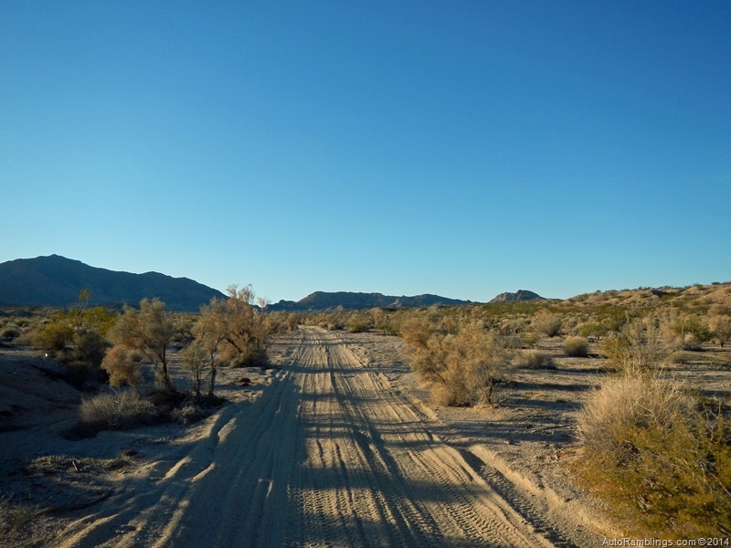
In the sandy sections there were only a few spots that were deep but still nothing that pushed me outside to lock the hubs. It was becoming more scenic for a desert setting.


Spiny cactus kept my radar up. I didn’t want to drive into one at all.


These things are mean and I wouldn’t want to tangle with any of em.

The trail was quite diversified, changing from a mountainous terrain to a flat sandy plateau. Not far up the trail the route would again cross over another set of hills.

(Looking back towards the Colorado River basin)
Soon the trail crossed over some of the steeper sections of the route.

At least the ground was solid and the trail wasn’t too rough.

The sun was setting and camp was a ways off. It looked like another night run.

This was possibly some kind of border crossing and maybe where the Preserve boundary started.
Time for some LED action.

The trail was pretty smooth until we reached the power line road. The spur to Fort Piute was very rough and slow going.

I don’t know if you’re supposed to camp at Fort Piute but we set up at the parking lot anyway. It had been a long day and with the wind blowing and cold temperatures, party time was going to be inside the van. With the late lunch still satisfying, alcohol was more on our minds.The first 23 miles of trail had gone well. It was a great night and it went quick but the drinking finally took its toll. Every time I woke during the night I wondered what the Fort looked like and was anxious for morning light.
I woke before the sun was up just to grab a few photos.

(23 miles from the Colorado)
Like I’ve said, it’s always interesting to see what you drove into during the night.

Besides the water located here, it was obvious that this was a good spot for a small Army outpost. The views were spectacular.
After coffee, we explored what was left of the old Army fort.

This was the main building on the site. The plaque showed the structures layout.


The main section of the outpost is not much to look at and somewhat hidden by the brush in this picture but just thinking about the soldiers who manned this “Redoubt??? really makes you wonder what it looked like during its hay day.

The main section of the corral is not visible but the section still standing in the picture above is shown in the lower portion of the Google image below.

Strange how the Google image makes the area look clear of brush.

Water was flowing in the creek but thick brush restricted the view.

We met a couple running the route.

Figuring they would probably out run me, we let them leave out in front of us. It was time to pack up and hit the trail.

Off camber and rough, the 2 mile spur up to the fort seemed to take longer than the night before.


Spiny beauty in the desert.

This was a site that was once a homestead and turkey farm located below the Fort along Piute Creek.

The original trail that once ran through and beyond Fort Piute has been re-routed down along Cable Road. The bypass trail runs south along the power lines for just a slight distance then splits off back west over the Piute Range which climbs quickly from 2450’ to 3400’ and continues a slower steady rise through Lanfair Valley.

(Colorful desert setting)
The trail started the climb at this point and although the picture below doesn’t show how steep it was, I had problems here.

I drove into a rut and got stuck. Attempting to back up, I ran the rear differential into a rock. We pulled the van out of the hole using the winch then stacked rocks in the rut so I could clear the bolder I hit. After the rear end was clear I could take a better stab at the trail.

Well the terrain got steeper and the trail became rocky and loose. The next few minutes was nothing but a struggle. I made several attempts in a couple of spots that had me scratching my head. Finally it occurred to me I might have screwed up.

Don was spotting and on my third shot I drove up the last section like it was nothing. Don yelled “man you just crawled up without spinning a tire, what did you do????
As I drove past him I said “I engaged the rear axle???. The whole time I was in front wheel drive only. Great! It sure didn’t do much for my front tires.
Off the grade, the trail flattened out as it entered the Lanfair Valley.

The path was smooth and the the ground was firm considering how sandy it looked.

(Typical terrain at +/- mile 34)

The Mojave Trail meandered in and out of gullies and washes but was mainly a nice lightly steady climb through Lanfair Valley. The trail climbs about 800 feet until it reaches Ivanpah road several miles away.

About half was between the Piute Range and the upcoming Ivanpah Road we found this old site. Lots of bullet holes none of which would end up being mine.

The road narrowed and became almost canal like.
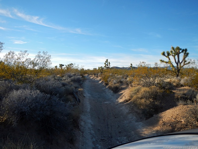
One thing I kind of worried about were cactus so close to the edge.

There just wasn’t a lot of room for a large vehicle. My tires rode partially on their sidewalls in spots.
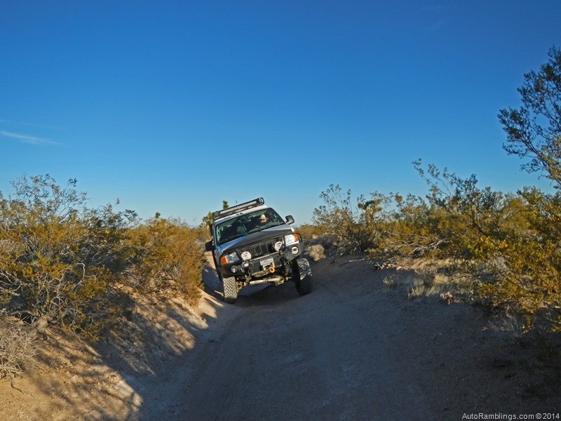
Some of the spots were way off camber. The trail soon leveled out again as we approached another Mojave Road landmark.

The Mojave Trail’s Penny Can Tree.

The word is that dropping a penny in one of the cans gives you luck while driving the trail. I wasn’t about to pass a lucky charm up.
The trail would soon cross one of the major thoroughfares. Ivanpah Road is a route off the Mojave Trail to leave out for supplies but it’s a long haul to the nearest store.

At intersection we found this plaque. The Ivanpah intersection is at about mile 47.

There were some areas down Ivanpah Road that looked like possible boon dock spots but one quick look sent us scurrying back to the trail. There was nothing to lure us off the Old Government Road.
The Mojave Trail was smooth here and you can speed through this section with a narrow vehicle but the Joshua and Yucca trees forced me to tuck in my mirrors at spots and pull back the reins. The Joshua Tree Forest sure slowed me down.

Would we ever find a camp? It was getting late.

I’ll have to admit, some of the sunsets like this one were unreal.

Absolutely beautiful but I would have been happier sitting in camp with beer in one hand and a fine cigar in the other watching the sun set.

It looked like another night run. Don was getting tired of setting up his tent in the dark but our destination was still a few miles away. There was supposed to be another campground or a nice camp up Caruthers Canyon. As we turned off the Mojave Trail I noticed something in the dark. A quick run up a spur took us to a stone cabin. It was the perfect spot. After camp was set up, it was party time. New Years Eve was upon us and it gave us an excuse to drink.

Shrimp skewers were on the menu along with other odds and ends. As an old man I rarely make it to midnight during the New Year Holiday anymore. Usually the alcohol shoots me down way before the hoopin and hollerin starts but by god I made this time. One thing I’ll never forget was the rum Don brought. Some dumbass kid at Costco claimed it was the best rum he’d ever had. That crap was rotgut. Now I’m not one to pour out booze BUT! Don said don’t do it, that’ll kill the snakes. Finally I could endure no more of that stuff and switched. But the music was good and It was probably the best night of the trip so far.
The morning came. OMG! Definitely the worse morning of the trip so far.

It took a lot of espresso to jump start our brains. The cabin was cool and looked like had been lived in at some point of time during my life.

At one time it was private property but many of those areas have been absorbed by the Park Service.
We finally broke camp and headed on our way. The couple we saw at Fort Piute came out of Caruthers so it was probably good we camped where we did. The music got a little loud while the New Years party was going on.

I was told this area has one of the largest stands of Joshua Trees around.


Again the trail got narrow and cactus reached out trying to grab at my tires.


The canals were back.


We didn’t know it but there was a road a stones throw away that paralleled the Mojave Road. Funny cause we felt like miles from civilization.

I found this the strangest part of the trail. It made me feel like I was higher up in the air than normal.

Even though this was a little rough, what was up ahead was worse. The trail ends up on Cedar Canyon Road and then cuts off and down into Watson Wash.

This doesn’t look bad but you’d have to be there. Skeptical, I decided to bypass this section. If I hadn’t been running the trail alone it would have been another situation.

From up top it was difficult to determine how narrow or deep the ruts were and short sections of the path were vertical in nature. This was by far the most extreme portion of the trail up to this point. Viewing it from the bottom gave a better perspective.

Watson Wash was the most sandy section to this point. The trail led to Rock Spring just up the trail seen in the background.

Rock Spring (mile 49) was another spot along the original Mojave path that was used by travelers that supplied water to those crossing the desert. The military had set up a small camp at this location but being the area has scattered petroglyphs it’s obvious it was also an ancient watering hole for tribal people and nomads of the region.

As shown on the map, proceeding back up to the main road (Cedar Canyon) and west led to Bert Smith’s rock house built in 1929.

According to the sites plaque, Bert had his lungs damaged in world war I and needed to find a dry climate in able to survive.

(Bert with his buddies)
Even though he was not expected to live long, the desert setting allowed him to survive another 25 years.

The Rock House was one of the only spots along the trail that had a bathroom.

Back off the Cedar Canyon Road we were back on the Old Government Trail.

Some unique rock formations and other oddities along the way toward the next main stop called Government Holes.

(+/- mile 52)

Looking at this set of rock formations screamed out ambush point and I wondered if it had ever been used as such.

Government Holes is marked by its classic windmill and water tank.

Used primarily as a cattle watering hole by outfits such as the Ox cattle company, the US army also used it for their needs. It was also the site of a gunfight in 1925 so there is plenty of history here.

There was quite a large corral located behind the cattle trough.

The trail quickly led back to the main vehicle route (Cedar Canyon Road) which crests out at 5000’. It’s the highest point along the Mojave Road.

The Cedar Canyon road was well graded which made it easy to quickly cover a large distance. Several miles were traveled in minutes on the road as compared to hours on the trail. A left spur off the Cedar Canyon road led to Black Canyon. It looked like there would have been plenty to explore if time allowed but the plan was to stick to the Mojave Trail. Looking at the map showed a several campgrounds, a recreation area and a spot to take a cave tour. The road continued on to Essex road and highway 40 but that would have to be left for another day.


We soon reached the Kelso-Cima road at mile 62. The railroad tracks looked used and the road paved.

A historical plaque about the Mojave Trail is along the paved road. After crossing the road the trail continued on its way through what looked like a large valley.

The trail became slightly sandy again but still didn’t require four wheel drive.

I thought this was one of the the most unique vista points along the route because the trail was visible meandering through the desert well into the distance. Camp was only about five or so miles off behind the hills in the picture.

The trail traveled over several humps and depressions that kept vehicle speeds to a specific minimum but it was actually fun driving this portion of the trail.

This was another section I thought the desert showed off its beauty.

This is a plant that has plenty of protection. A close up of its needles is enough to see it was a desert dweller that could damage a tire.


The trail continued its climb and provided some great views of the valley we had just left out of.


For once we were on time. Upon pulling into camp, it was nice to see that the sun had not gone down yet.

(+/- mile 67)
This was the best site so far and there was plenty of room for several vehicles if need be.

There was no plan on drinking this night but food was on our minds. I also got out the propane fire for the evening.

Don said his head was still thumping making it difficult to set up his tent.

After the sunset, the winds came up and it did get cold.

Filet mignon wrapped in beacon, stuffed mushrooms, spinach/cheese mini quiche, couscous, and sweet bread was served for supper but the thought of alcohol was far from our minds. After dinner the winds made it difficult to stay warm and to tell the truth New Years had taken out the gusto in both of us. We both took the opportunity to get in a good nights rest.

A night without drinking was well appreciated in the morning and made for a fresh start to the day. We chowed down on some mini ham & cheese sliders using English muffins as the bread medium and espresso to take us into warp.
Back on the trail the path climbed towards the Marl Mountains.

Another mean machine of the desert.


Every now and then you see a desert setting that you’d like to have somewhere on your property.
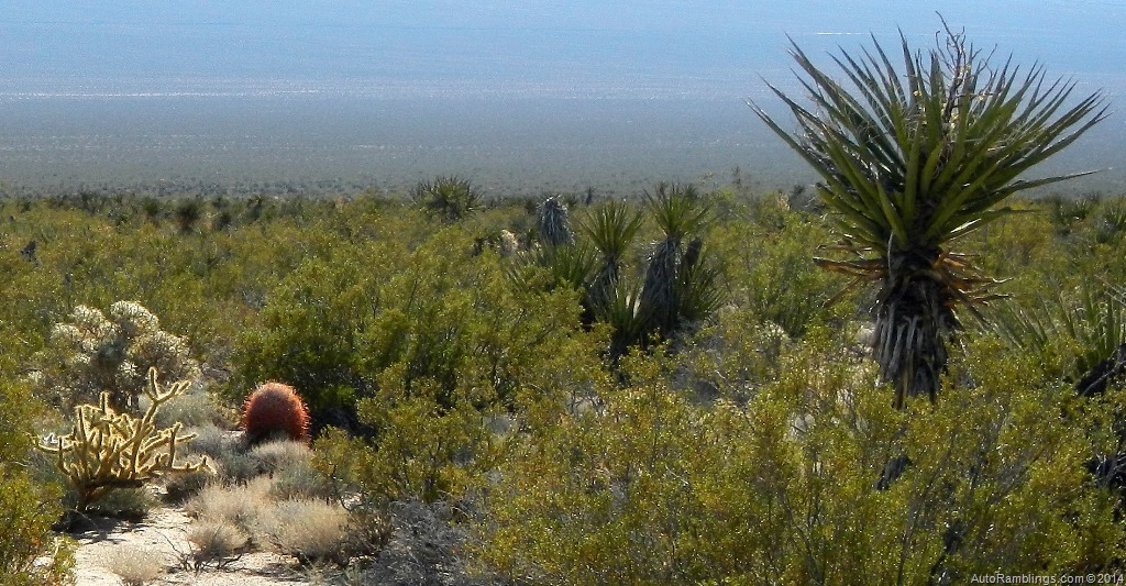
This was one. The only thing missing was the huge Joshua Tree.

(+/- mile 70)
Not far from where we camped, the road passed a spur that led to another one of the trail main focal points. Marl Springs like Rock Springs was occupied by the military during the 1860’s. It was important primarily because it served as a midway point between Fort Mojave and Camp Cady. The spring provided water for travelers and the military as well as Indian tribes who used the trail long before the white man entered the region. Several trading posts were also built on the site over the years.

It’s difficult to see the ruins of the outpost and any of the buildings left, but fence posts and a corral are still visible on the site.

The trail skirts around the Marl Mountains.

Soon the route passes under a few sets of power lines. The trail climbs a bit before dropping into a flatter terrain.
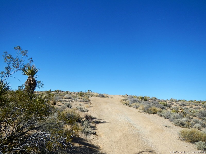
Another very steep section that is difficult to capture on camera.
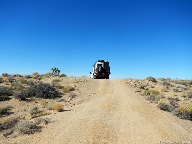
I did throw the vehicle into 4×4 but it wasn’t really needed.

It was another high altitude point along the trail.

Again the path travels through a high desert plateau. The trail was a little sandy but still didn’t require four wheel drive.

One of the ways to tell you’re on the Mojave Trail are the rock cairns along the path.

Although this section of the trail was obvious and didn’t need to be marked, some areas are difficult to find and the cairns are extremely valuable.

We soon reached the Mojave Mail Box at mile 74.

This is a place to stop and register. It helps keep track on how many travelers visit the area.

It’s loaded with stickers and if I had known I would have brought a SMB Forum sticker.


We signed the book. Looking at the previous signature we wondered how those folks we able be beat us by a whole day. These were the same couple we had shadowed throughout the trip. I claimed they were hauling ass to be a day up on us.
Before heading out Don yelled he saw a spot where somebody had dumped trash. Further inspection revealed the Frog Shrine.
(Click on images to enlarge)


Yep, I done forgot my frog damn it. Seems Huell was the one who told me about this place. Like Teakettle Junction in Death Valley, rather than a teakettle, you’re supposed to pack a frog to leave at the frog shrine. I had to laugh that the sign said “Frog parking only, violators will be toad???.
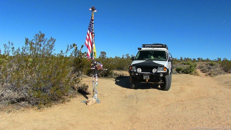
As we left the Mojave Mail Box area, the Sirius satellite kept referring to New Years Day??? After putting two and two together, it was obvious that “today??? wasn’t the 2nd of January… it was the 1st. Now I finally knew how the couple we had shadowed were a day ahead of us. They weren’t, we were actually a day behind but only in our minds. We had partied thinking it was New Year’s eve when it was the 30th. We’d slept right through the real New Year’s eve. See what happens when you get old!

(+/- mile 77)
As the trail rolled through some of the sandiest terrain so far, the lava flows began to appear. We didn’t take the time to visit the lava tubes just around the corner. Next time I’d like to spend more time on the trail. There were several great campsites along the walls, many that could hold several vehicles. Knowing that one of the main roads that led directly to Baker was less than a few miles ahead, the goal at this point was to get to town for some ice. How can you have a cocktail without ice? We were on a mission. As soon as we hit Kelbaker road it was time to air back up. A gal in a lone Jeep came out of the hills to ask if we were OK. I explained we were just filling the tires so we could head toward Baker. It’s nice when folks ask if you’re in trouble…kind of a backcountry travelers code. She was looking for Petroglyphs and asked if we’d seen any.
We had found a canyon just off the trail and decided it was the spot for our next camp. It was time to go find ice.
Leaving out on to the paved road we came across Erika once again and pulled over to give her some information that might be pertinent to her quest.

What a great gal. Erika was from Mexico City IIRC and on an expedition. She laughed showing her supplies explaining that you can never have enough!

Sometimes the best part of a trip is meeting people like ourselves who have things in common. Don and I both wished her a safe journey and headed on our way. Hopefully she will read my article.
Back from Baker, camp was set up for the night. It WAS the best spot of the entire trip.

The lava flows were a sight to see and as the sun set the colors came out.


Hard to beat a sunset like this. Time to once again get the spirits out!

Absolutely awesome. Thankfully the weather was clear. This was the base of a currently dry waterfall. The canyon walls kept the wind at bay as well as adding a scenic background. The propane fire paid for itself that evening by kicking the cold weather’s ass. Being we had supper in town all we needed to do was pour the booze and pick out a good cigar. Sirius radio cranked out some good oldies…U2, Dishwalla, Porcupine Tree, plus a good live one with Frank Marino & Mahogany Rush. Times don’t usually get as good as it did that night.


In the morning it was time to pack up and hit the trail. This was a camp that I’d definitely want to stay at again but looking at the picture on the right you can see that rain might pose a huge problem in this wash.

After crossing Kelbaker Road the Mojave Trail continued on its sandy path.

The rock formations were colorful as was this shot of a barrel cactus.

It was a straight shot toward the soda lake bed. Personally I thought this section was somewhat uneventful. Still, being in the middle of nowhere was kind of cool.

At the outskirt of the soda lake the trail was soft which left a lot of dust behind my van.

(+/- mile 97)

The powder from the trail is very caustic and eats at some metal on your vehicle. It’s probably a good idea to clean your ride ASAP after leaving the trail.

This reminded me of Death Valley around Westside Road opposite Badwater.

In some ways it looked similar to the Devil’s Golf Coarse in DV’s main valley. Next stop was the travelers monument at mile marker 100.

Because neither of us had been here. I wondered what the plaque said. Well here it is.

Yeah, I’m playing the game. You wanna know? Go search…you’ll probably find it but so much for the tradition. Call me old fashion.

This place provided fantastic views at dusk.


As the sun set, it was clear that camp would have to be found after dark. Once again the LED off road lighting would come to the rescue. Rasor Off Road Park (mile 103)was up ahead and the thought was that there would be some nice spots to make camp at. But similar to Mule Team Road, the park was occupied by those off roaders we would rather leave behind. So it was back to the Mojave Road as the light diminished,

After leaving the flat terrain of the soda lake, the trail began its slow upward grade over one of the last mountain ranges before dropping into Afton Canyon. It was the most difficult night drive yet. Luckily the trail was identified with AC trail markers. Once over the range the trail dropped into a very sandy region at +/- mile 106. Unfortunately the trail split into several paths and the only markers were rock cairns that were very difficult to see at night. At one point I thought I completely lost the main route and had to backtrack to find the trail. This was one spot I had to have my 4×4 engaged. It was very soft and resembled the previous year while running the Manix and lower Mojave wash. Everything here at night looked the same making it almost impossible to keep on track so it was time to find a flat spot and call it a night.
After setting up camp we once again had to party inside being the winds made an outside propane fire impossible. Later that evening here they came. A couple groups of ATV riders flew by us. Strange seeing that these vehicles had various colored LED whips which gave a interesting look as they flew by. Awesome safety devices. Thankfully they all just drove past us and came back later before we decided to crash out.

The Morning produced a fairly nice sunrise.


Time for a little breakfast and a kick of coffee before hitting the trail.

Besides the cairn trail markers, there are a few spots with old railroad ties stuck in the ground that signified the path.

This sand dune area was the most difficult section to navigate but most all of the numerous trails ran in the same basic direction.

Looking over it was obvious that the trail was where the cairn was. No big deal.

Even here I didn’t need four wheel drive. This doesn’t mean a two wheel drive only vehicle is OK to run this part of the trail. I’m sure it’s different at various times of the year.

Approaching Afton Canyon the trail firmed up as the terrain began to change.

(+/- mile 115)

Finally the first railroad bridge was in site.

This was the start of Afton Canyon.

Plenty of clearance. I was kind of hoping for a train to pass by for a good photo opt.

Afton Canyon is often referred to as the Grand Canyon of the Mojave and it’s easy to see why.

The place was very cool looking and I wish we had more time to explore.

There were a few spots that looked like great places to boon dock at.
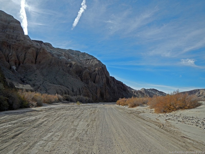

Even as dry as it had been, the Mojave River was still lightly flowing. I’d call it more of a percolation event though

The trail soon leaves the canyon and runs up along the RR tracks.

I wonder what this trail would be like during a wet year.


As we left out of the Mojave River, the trail became part of the railroads patrol route.

The river takes a turn as the trail continues along the tracks.


The river quickly cuts back and the bridge crosses it at mile 121.

This is the first river crossing. During a wet year the river might be a challenge to cross.


There was a fence to measure the depth by but unless you know how tall it is, actually measuring the depth is the only way to safely cross.

The trail itself was hard based and not muddy or soft at all.

The trail crosses under the railroad and keeps going to the next river crossing not far away.

This section was a bit deeper than the previous crossing. Same as the last river crossing, there were ways to measure the depth provided you’re familiar with the road. I also ended up with reeds and plant debris wrapped up on the undercarriage after emerging on the other side.

End of the trail. I had no wish to run the lower section through the Mojave and Manix wash areas. Once with a single vehicle was enough for me. Nobody was at Afton Canyon campground but it was early so heading out toward home made sense rather than spending the night there. The less time on the road the better. Knowing what I did after running the trail, it would have been nice to spend the last night in the canyon. Hindsight is 20/20. Overall it was one of the best trips I’d ever done. One day I’d like to run it with more vehicles and spend more time checking out the highlights that the trail offers. This was a good one for sure and will be stuck in my memory bank for a long time.
The ride home was uneventful but had me longing for the next adventure. Hey, at least nothing broke this time.
Summary:
This trail is a classic route. The history is interesting and although the trail isn’t actually remote it definitely feels that way. To me it was almost the definition of an expedition. There just aren’t many off road routes that offer what the Mojave Trail does within the lower US. You should be prepared for desert travel and plan according to the current weather which can vary widely depending on the time of year. Both well equipped smaller or larger 4×4 vehicles are suited for the run. Sand seemed to be the biggest issue so knowing how to deal with it is a huge plus. Three days is plenty of time to do the trail but more time allows visitors to fully explore the area. I actually think spending a week is doable…maybe more. I’d like to revisit the area soon, especially with a few more vehicles. One thing for sure, next time I’ll be traveling with the Mojave Road Guide book. At least I’ll see what I missed the first time around.
Thanks for following AutoRamblings Sportsmobile 4×4 Adventures
]]>