
The Laurel Lakes Trail
Posted on September 5th, 2007 in Uncategorized | 2 Comments »

By Dave Boyer
Location:
The east side of the Sierra�s off highway 395 just outside Mammoth Lake California.
Season open:
Between April and November. Weather permitting.
Elevation:
7,000-10,000 feet.
Nearby Facilities & Camping:
Mammoth Resorts and local campgrounds.
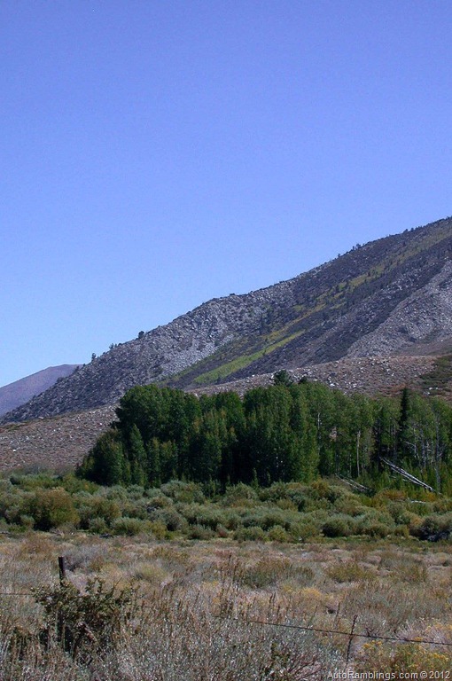
The Eastern slope of the Sierra Nevada�s holds a number of trails offering a variety of chances to explore regions that range from desert type zones to high altitude alpine settings. The trail into Laurel Lakes begins in a shrubland type Montane zone that holds sagebrush at the lower end of the trail and then continues through a series of Aspen groves as you climb in altitude. After traveling across a loose open sharp rock portion of the trail, you�ll eventually end in a more Alpine type setting typical to the upper Sierra Nevada�s. The contrast between the zones is quite striking especially during autumn when the trees are producing their abundant fall colors. Due to its location and length, this one way trail can be done easily in a day but because the lower section is very rocky and slow going, adjust your schedule to arrive early as possible. Besides, it�s easy to spend a good portion of the day shooting pictures so expect to add time for that alone. A day of fishing or just a picnic at Laurel Lakes rounds out the day nicely.
It�s best to obtain a Forest Service map of the area. Although there are several paths that lead into the trailhead, most travelers will want to fuel up in Mammoth before heading up to Laurel Lakes.
(Click on smaller images to enlarge)

The Sherwin Creek Road (4S08) is a well use back road that loops from the Old Mammoth area back south and east to highway 395.

Traveling east from Mammoth towards the Sherwin Creek Campground, continue past both the campground and Summers Road.

The main road travels through pines then breaks out into a more open area
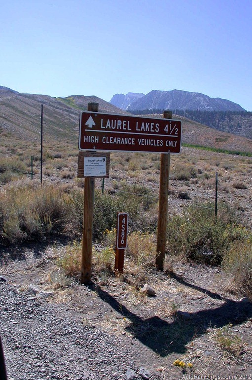
After crossing Laurel Creek (which may be dry depending on the season) the trailhead sign to Laurel Lakes should be visible.
Although the beginning of the route travels through flat terrain, it soon changes.
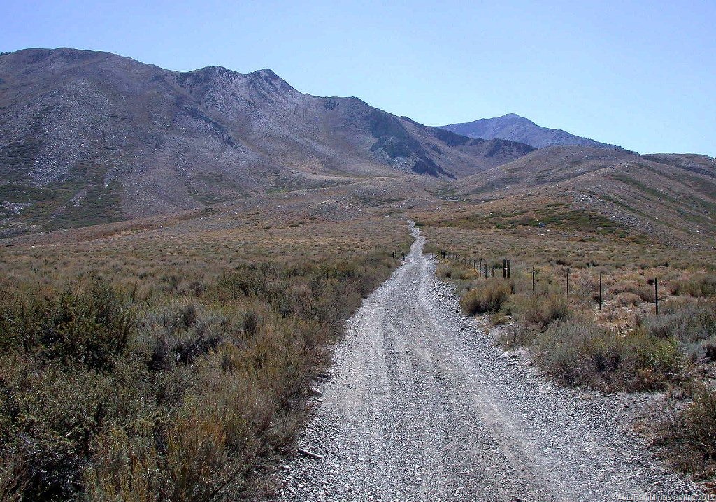
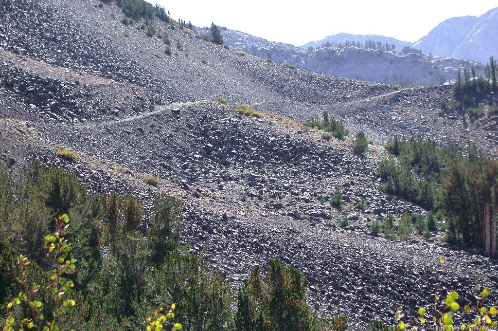
The lower few miles of the path has mid-sized rocks that require a slow pace as the slight climb leaves the shrubland zone.

After a while the trail begins to smooth out as you enter Laurel Canyon.
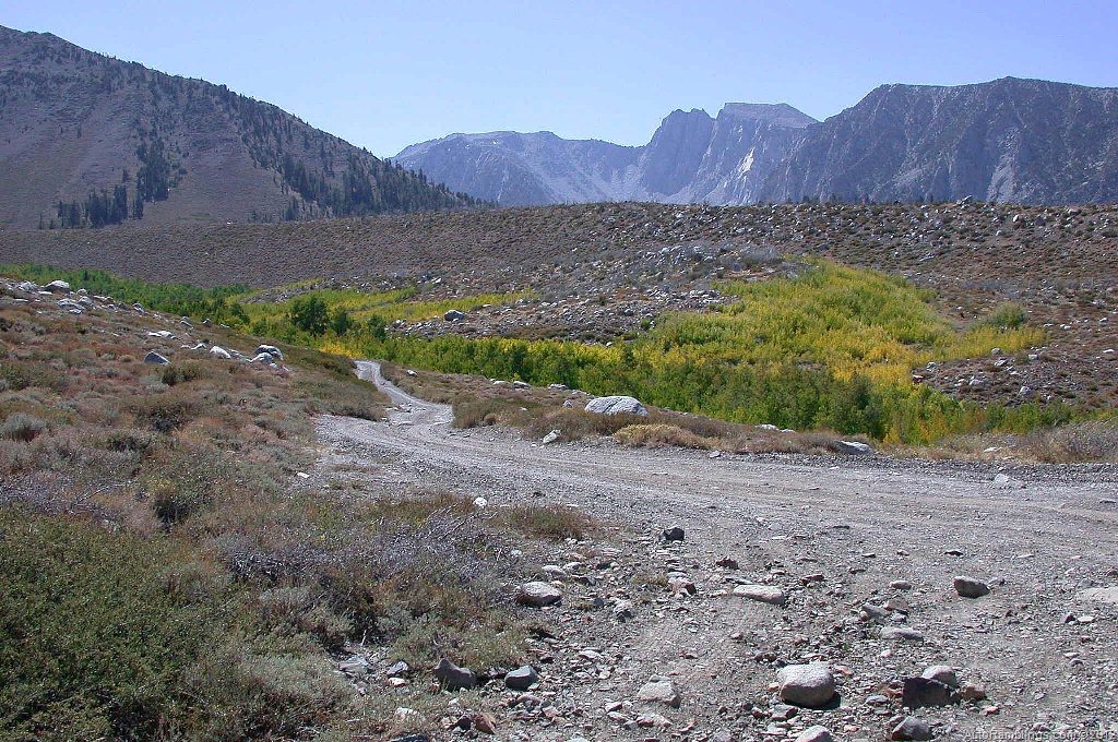
The trail passes through a few of the several Aspen groves located throughout the canyon.
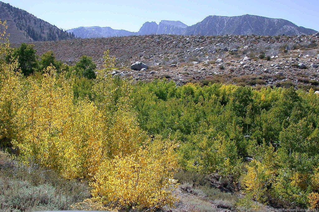

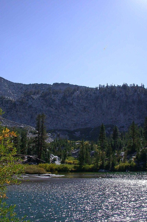
Views of the canyon are impressive in my opinion. The trail parallels Laurel Creek from an elevated level to the back of the canyon where the creek cascades down into the basin.

As you start to veer away from Laurel creek, hidden in one of the Aspen groves is a really nice camp along side the stream. A less marked trail leads to the camp.


Soon a series of switchback begin to wind towards the upper section of the trail.
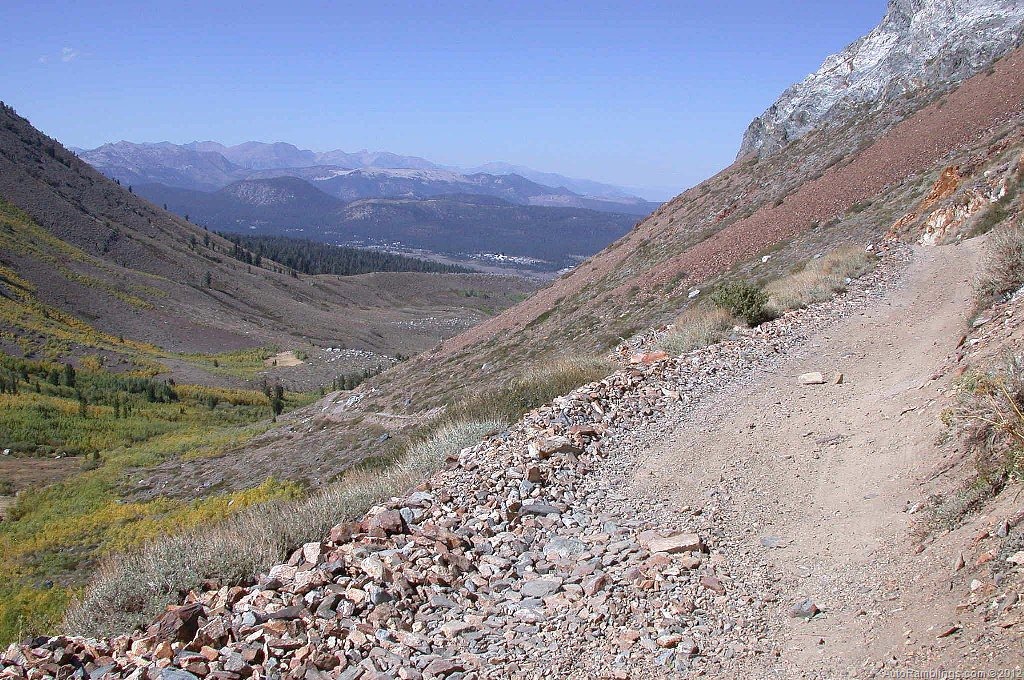
From this vantage point looking back down the canyon offers some premium views of the surrounding region including the community of Mammoth Lakes.

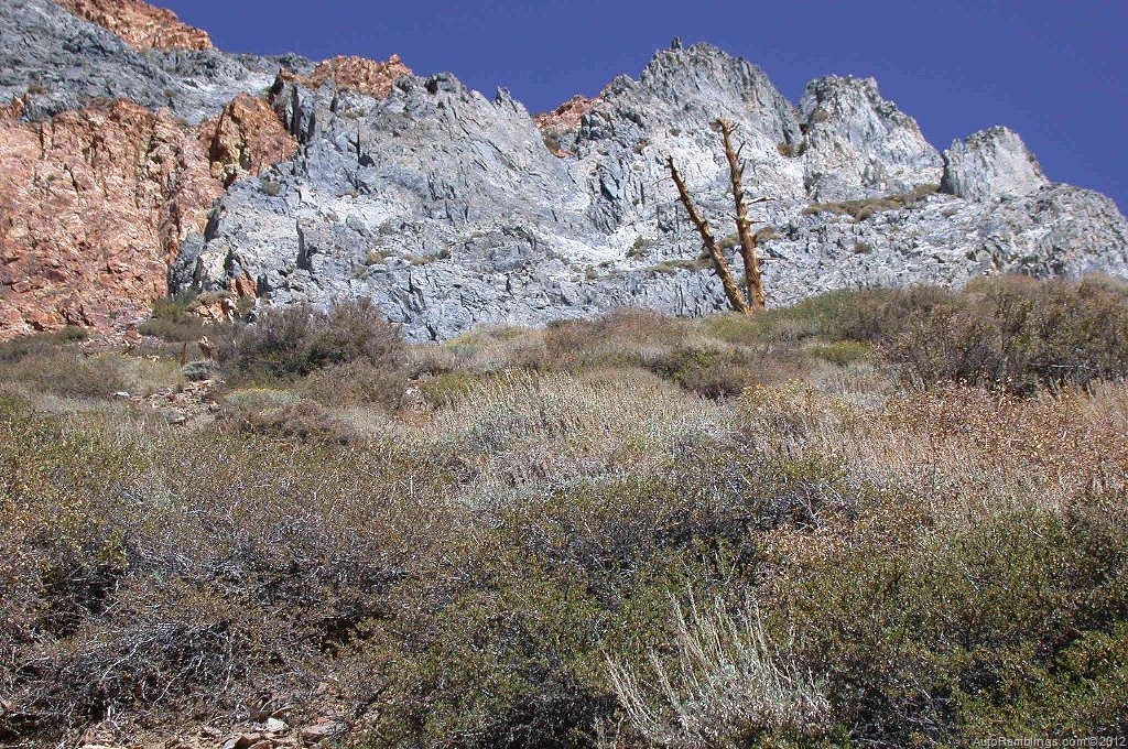
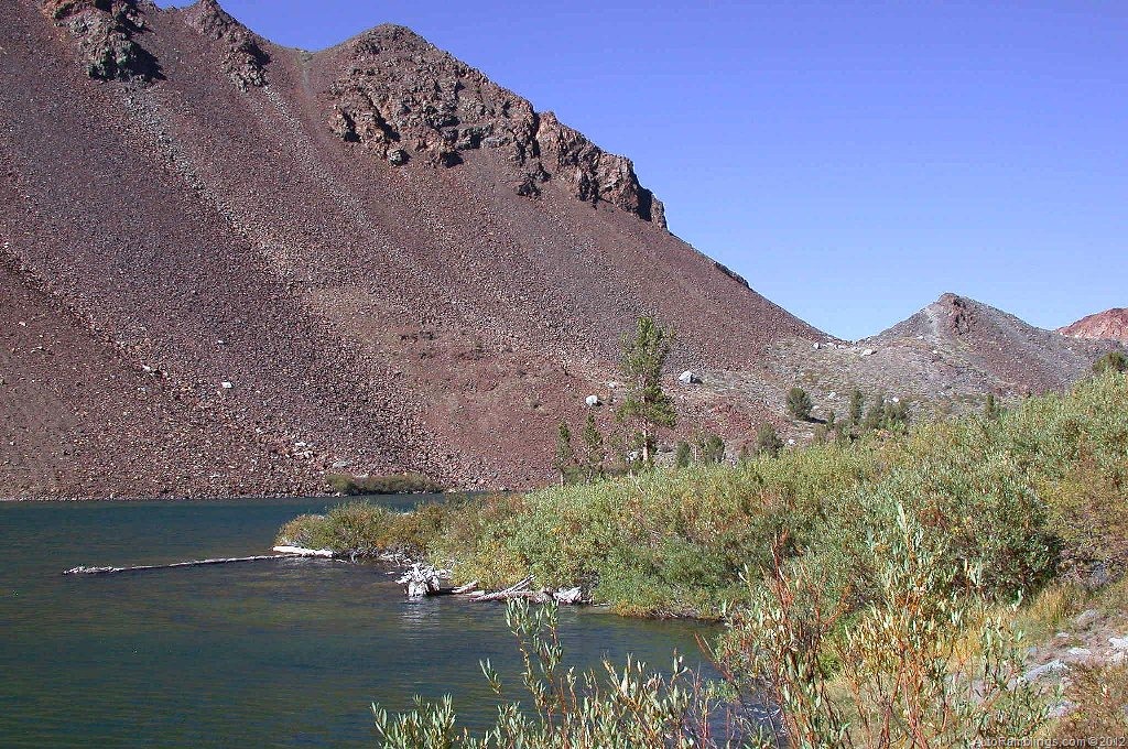
The mountain range above the trail are also somewhat unique.
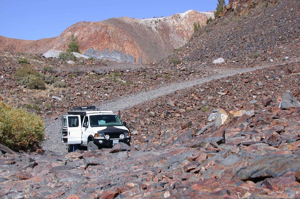
The path eventually leaves the first set of switchbacks and straightens out for a short distance. This section of the trail follows a shelf path that may be intimidating for some drivers and passengers. Pictures really don�t do the terrain justice. Even the image below of me leaving out doesn�t show what you�ll �feel??? while driving on this portion of the trail. It seems much more vertical.
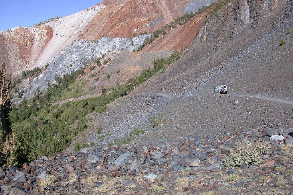
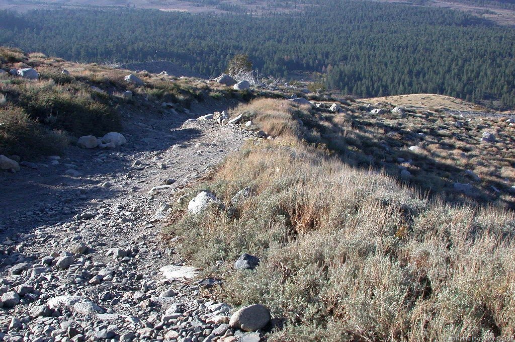
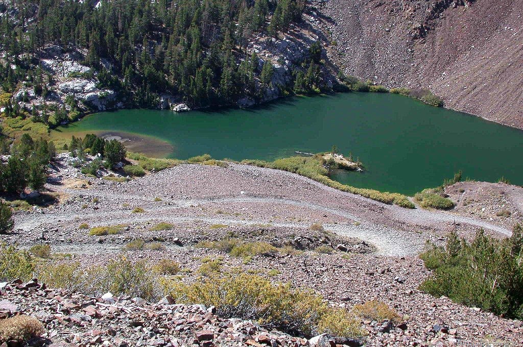
The trail will test the condition of your tires due to the nature of the loose sharp rock that�s found here. Not only can it puncture a tire but the loose rock provides a limited grip as you travel. Your vehicle will produce a unique sound as it drives over this terrain. At the crest of the trail, one of the few pullouts will provide an excellent view of the lake.
From this point the trail begins to descend to the lakes through a number of tight switchbacks, one of which that requires a multipoint turn. This picture below was taken on the way out.

On the way out I didn�t need a spotter to get through this switchback but on the way in I was glad I had someone with me. A full sized van like mine can make the trip with no problems so pickups with four wheel drive and a reasonable lift should have no problems. The drop into the lake area is fairly steep but easy going.
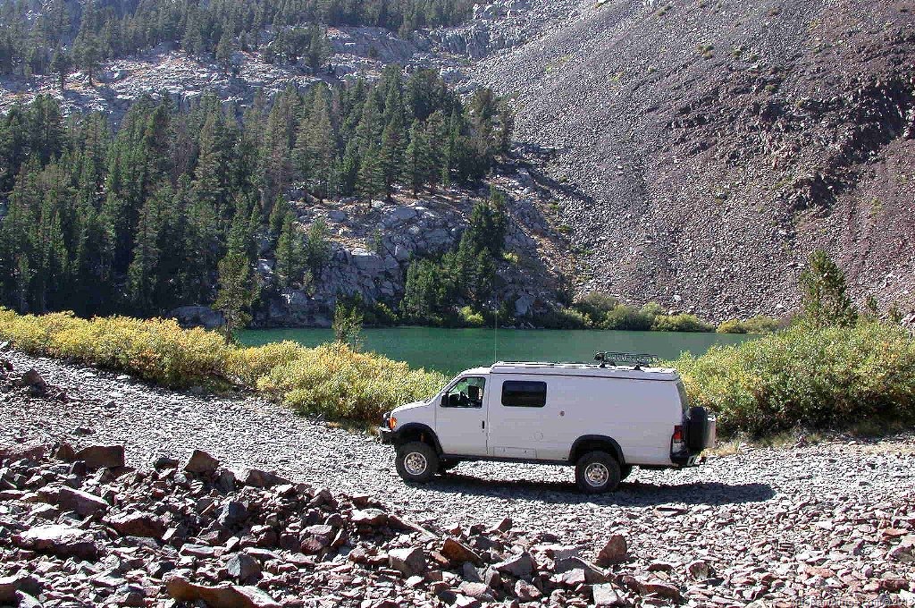
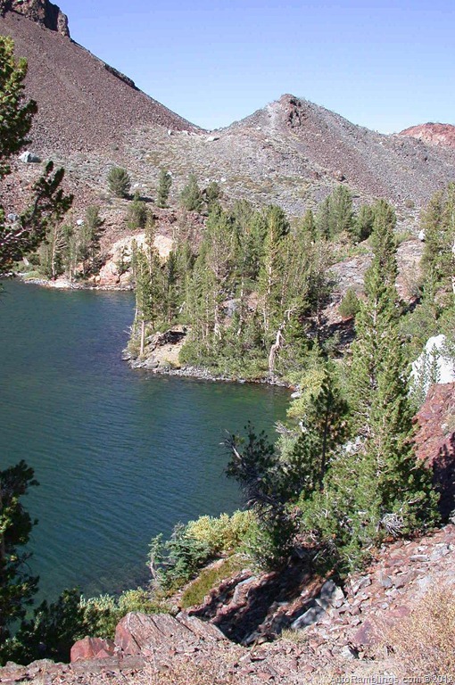
The lower lake area is where the vehicle path ends. The time was a bit short and we had to rush to make lunch and do a little sightseeing.
The lake would be a nice place to stay. During this time of the year the mosquito’s aren�t a problem.


The lunchtime bells ringing! Beer and a sandwich� what am I doing up here?
Time to pack up and head out. Although we didn�t have time to fish, staying here at the lake for the night would have been nice. There aren�t too many spots for tents but a vehicle like a Sportsmobile doesn�t have a problem in this terrain. But our base camp was several miles away and time was ticking. Time to get back to camp for a fire and a few more brews.
Summary:
The Laurel Lakes Trail rates a 10+. The views along the way are superb making this trail a fine scenic route into the high country. Fall is a great time to visit when the trees are turning color but springtime with its snow covered peaks is also a beautiful time to explore this region. Provided you have a vehicle capable of driving this terrain, the short drive to the Laurel Lakes is well worth the time and effort.
Thanks for following Auto Ramblings Sportsmobile 4×4 Adventures.
Maybe see ya on the trail.


2 Responses
The color of the High Sierra rocks are beautiful. I had no idea that there are these kind of 4×4 trails west of the 395 and so close to Mammoth Lakes!
The place is unreal especially in the fall as the colors turn.