
A day at work
Posted on July 20th, 2014 in Uncategorized | 4 Comments »
 It�s horrible when the company sends you on an emergency off road adventure. Well maybe not. Although it can be inconvenient if it takes you away from doing something you�ve planned for the day, I�d never turn down being paid to do some off roading in the local hills.
I�ve never posted about work before so this is a slightly off topic article. The area I was dispatched to is a place I�ve worked and visited my whole life and holds many memories. The problem for those who read this posting is the trails are on private property and off limits to most people, so like other posts on my site, forget planning to visit these trails.
My job is working for a public utility that supplies power to local communities. Besides the building and maintenance of the power lines I�ve done over the years, from time to time I�m required to inspect and patrol them. This trip was a standard relay patrol where I was looking for a problem. I didn’t use my SMB on the drive, but as required I drove my work truck, a 550 Ford 4×4. The post is more pictures than text and the area isn�t the most scenic but does hold historical value.
La Grange:
The area is around La Grange CA. and nearby Don Pedro reservoir which is best seen in the springtime when the grasses are green. But summer does offer its own unique view. This region was a gold rush zone and La Grange is an old 49er mining town. For whatever reason, when the grasses are brown it reminds me more of the old west. I�ll probably credit Hollywood for this. In fact movies like High Noon and several TV westerns were filmed within a few miles of La Grange. Many visitors come to see the La Grange for mining history and Huell Howser did a show on town that’s worth watching if you like "his style" of reporting.
http://blogs.chapman.edu/huell-howser-archives/2010/01/14/la-grange-californias-gold-12010/
After the gold rush era, La Grange was considered a company town during the mid 20�s as the dams were built to provide water to California�s central valley. As I mentioned, the company I work for provides water and power to the region and is best summed up in a video produced a few years back. Although slightly �cheesy??? IMO, it does provide a glimpse of the history of the area. Be aware it is HD and a large file that eats up air-card time or a smart phones minutes when downloaded to view. One thing about it is it does discuss the Yosemite Hetch Hetchy project that is in the news these days due to the ongoing drought.
The drive:
I did it in sections and picked each area with regard to accessibility, time and terrain. The post is loaded with pictures that I hope just gives you a feel of the area. It�s a shame that private property restricts us from visiting areas like this that were once open to the public many years back but the times are what they are.
My starting point was along standard roadways and I didn�t take any pictures of being accessible to the public. The first gate unlocked took me in to an area behind a small power plant called Dawson Lake that Huell drove by in the start of his video.

This area was mined for gold for several years.
The creek can run high during heavy rainfall and I�m not a fan of visiting it during wet weather.

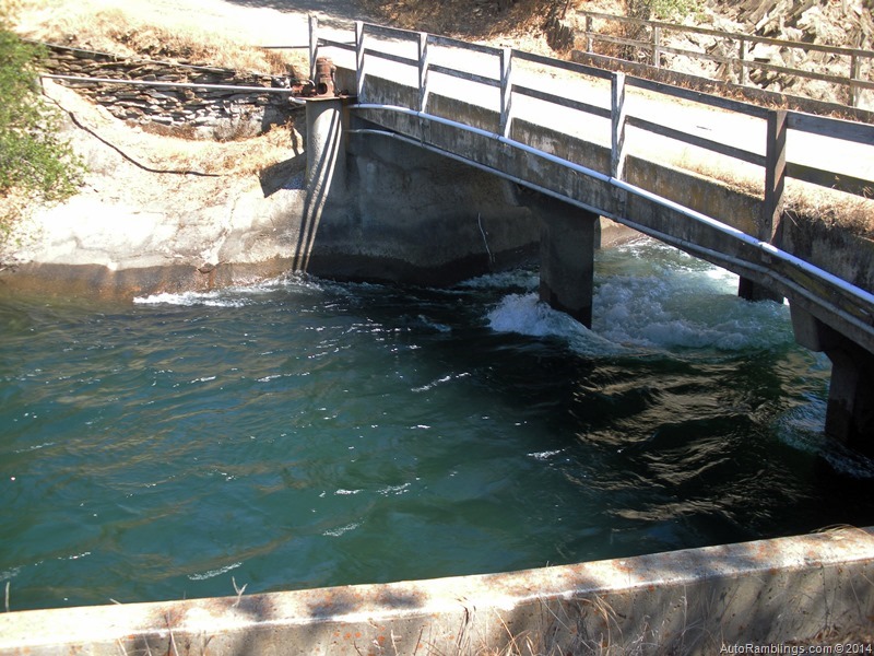
Upper Dawson fore bay.

Before the power plant was constructed this was a highway. Now it�s a cattle path.

I�ve been told the fishing is fantastic at Dawson but I can�t claim it�s a valid statement being employees might suffer termination attempting to do so ![]() .
.

It�s hard to get the perspective of the terrain but this was a very steep drop off that required four wheel drive.

These are canals that supplied water for mining.

More prospects. The cliffs in the background are filled with tunnels built by those looking for gold.

In the 1983 I had a rare chance to photograph and waved at Queen Elizabeth (The Queen of England) as she and her motorcade passed by our crew working in the area shown below. They had just came from a stay at Yosemite while visiting the US.

Not much has changed from back as seen in the picture below except my age.

The poles in the background were installed while we were stringing wire to keep them from falling into traffic. At the time we didn�t know there was a multiple fatality involving a sheriff and a Secret Service vehicle that collided up the road and that law enforcement was in high alert. A CHP helicopter circled me and told me to get down off the tower structure and go to the road. The Secret Service told us to stand at the road and keep our hands at our sides. I thought it strange they had automatic weapons on their laps. Because we didn�t know what was going on, I was not about to pass up snapping a picture of the queen driving by us and the whole crew waved at the entourage. Nobody got shot thankfully!
There was a huge town welcoming in La Grange only a mile down the road that day.
Back to 2014. It was time to cross the highway and head up toward La Grange dam.


Argg, a damn tree had fallen across the trail. I had to winch it out of the way and wasn�t too happy about having to move it.

Our main canal.

A close up of where I had to drive in this picture above is shown below.

The trails are confusing and I had to use Google Earth images to guide crews in to the area to make repairs at a later date.


Summer colors.

Talk about a fire hazard.

There is a 12kV distribution and two 70kV transmission lines. The distribution line and the smaller tower line were built in the late teens and early 20�s. The transmission line was one of the first power lines in the world that utilized aluminum for the conductors.

An old structure that once diverted water from the Tuolumne River to the gold fields.


The spot of an older powerhouse prior to the public utility taking control of the river water rights.

On the road to La Grange dam and the next section to patrol.

The Tuolumne River.

La Grange powerhouse.

The rocks were hand stacked and inserted in the late 1800�s. This place has been here a long time.

The La Grange dam is the stopping point of the Chinook Salmon that annually run from the pacific ocean to spawn here. In the past there was a 20� net at the powerhouse to scoop up fish from the river provided the game warden got his quota as well. My how things have changed.

Water heading down to irrigate a desert region that helps feed the world.
I had to cross an old bridge to finish patrolling the backcountry.

Here is where the real off roading began. Getting equipment and materials in here can be a bit of a challenge especially in wet weather. A cat had cut the trail prior to my visit.


New Don Pedro Dam off in the distance.

In 1997 we had what was called the flood of a century. For the first time flood gates were open and it cut this swath through the mountain range.


This poor image shows the water flowing into the Tuolumne River diverted around Don Pedro dam. There had to be some good gold washed down here into the river.

Looking into the central valley.

The trail breaks out onto a high plain. A few years back I saw a 6� rattlesnake here.

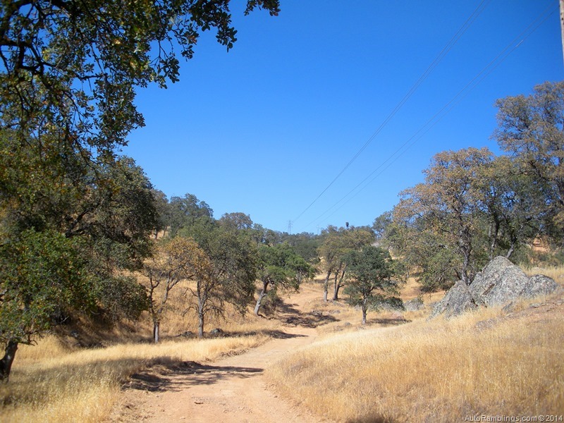
The trail runs through a Oak forest.

This is what woodpeckers do to the poles. I�ve been told they store acorns in the poles in hopes of finding insects that eat the acorns later on. A food bank so to speak.
The trail gets a bit more rough as it climbs.

Again, it�s hard to tell from the image but the climb out of Buzzard Gulch is steep and requires four wheel drive.

Damn!

I side walled! And it was a brand new tire. Thankfully it was only one dually. I limped my way out.

Close to Pedro I felt a bit better. Time to call the shop.

Hard to get service like this in the backcountry but if need be they would have met me in there. I was able to make it to the recreation area shop this time. All I was thinking was what if this had been my SMB�sweat city.
By the time the shop made the repairs it was getting late. I didn�t want to patrol at dark. That requires a lot a walking and it was still hot outside. I headed back to lower Dawson Lake and headed back down for the last segment I needed to look at.

The tail race out of the powerhouse shown here is great fishing�er, I�ve been told.

Many sneak in to fish this lake�not me of course.


I thought I found the problem but all looked OK. I could see the heads of the fledglings looking over the nest. We have a lot of Eagles that nest in the area but this was an Osprey nest.

Back on the move.


Nope, not the Devils Tower but kind of looks like a mini version. Actually a gold dredge had moved through the area between the turn of the 20th century and ate up land until the 40�s.

It resides here in a pool of water.

It�s now a historical landmark.
The dredge was wide open back in my youth and while we worked the area rebuilding the transmission lines, we frequented it. Many times I explored what was left from a time long lost. Over the years, parts were removed or scavenged until it was classified as a monument.

The Tuolumne Dredge (similar to a floating barge), worked its way from the Tuolumne River basically creating its own waterway and pond. A dredge spud (usually a pole) was placed in the pond and with the dredge connected to it, the floating barge spun in a semi-circle collecting all the soil then separating the gold from the ground it dug up. After running all the soil, it would move to its next location starting the whole process over again. Leaving tall mounds of river rock behind it, the normal landscape was basically altered for years to come. In fact many areas are still scared today from where this mining machine gobbled up the earth almost three quarters of a century ago. Today the some of the tailings left behind are processed to make a variety of gravel and aggregate materials.
Back on the trail the sun was slowly setting in the west.


At times this can be an issue crossing but not in a drought year.

This pond which was part of what the dredge tore up is now a haven for wildlife. Who says mankind wrecks everything!

More oak tree area.


Night approaching.


Thankfully I was getting close to the end of the backcountry patrol.


The moon rising.

Gorgeous ending to an off road adventure. I still had about 5 miles of line to run out. In the end I found a Mylar balloon that tangled up on the feeder line in town. Sometimes I hate running out this line but it does have its perks. I drove from LA once when the dispatch called me when I was at Deaver Springs having new spring packs installed. Now that was a long day of driving for sure. 350+ miles of asphalt followed by 50miles of dirt. Why did I answer that phone ![]() The answer is it put a big dent in the price of the spring install,
The answer is it put a big dent in the price of the spring install,
This job took me 12 hours�all in a days work.
Thanks for following AutoRamblings Sportsmobile 4×4 Adventures.


4 Responses
Davey ,
You are an amazing Human Being ! This was great log entry and I am jealous of all that you get to see in the untraveled areas , thank you for sharing
Gregg
Thanks Gregg. We need to do a trip one of these days.
Dave
“David” (to be said with a British accent)
I’m glad I was on vacation as you put up an excellent blog entry! At least I enjoyed it…I felt right at home, haha! And you finally got a little $kickback$ for all your fun blogs!
Thanks for not answering the phone that day Steve. I did have things planned that day though including having a few beers that got put on hold. The things we have to give up to keep the customers and company happy.